U of M's 500-year-old map shows first reference to America
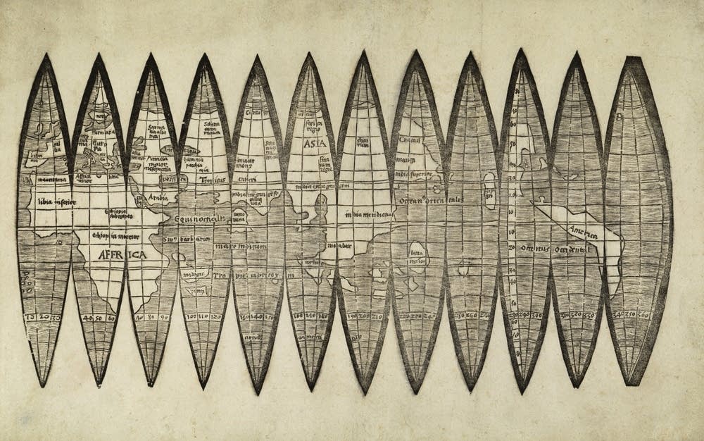
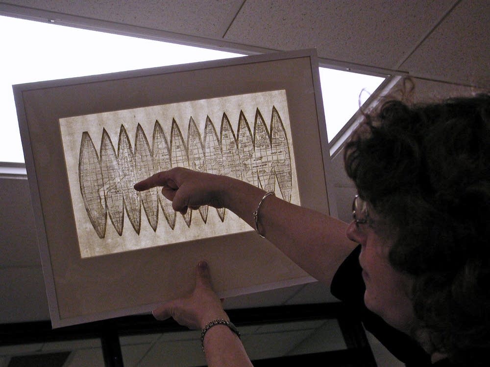
The Waldseemuller globe gore map strikes an unassuming profile. The black print on paper is 15 inches wide and less than 10 inches high.
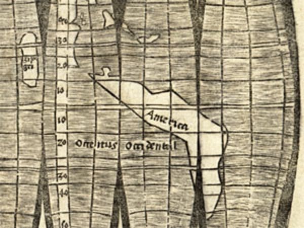
But the word "America," assigned to a sliver of land barely known to exist at the time, puts the document among a rarified handful that signaled a major shift in how European society viewed the world.
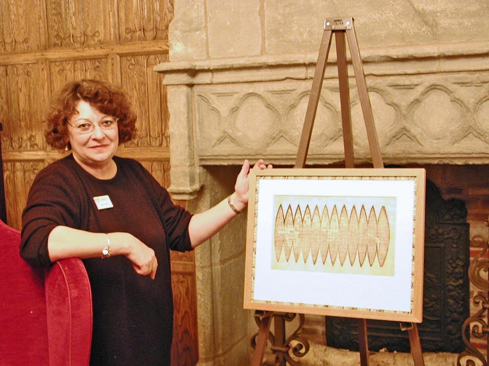
Bell Library Curator Marguerite Ragnow says the map, produced by German cartographer Martin Waldseemuller, used the most up-to-date accounts of distant voyages.
"Waldseemuller's reputation as a geographer was so good, and his work was picked up by other geographers and cosmographers, and that's how it spread. And so we have it in many different books within a year, two years, three years," says Ragnow.
Create a More Connected Minnesota
MPR News is your trusted resource for the news you need. With your support, MPR News brings accessible, courageous journalism and authentic conversation to everyone - free of paywalls and barriers. Your gift makes a difference.
Specifically, the map, printed the year after Christopher Columbus' death, invoked the written accounts by Italian merchant Amerigo Vespucci, who deduced the land to the west of Europe may be distinct and not the eastern coast of Asia as Columbus thought. Waldseemuller paid homage to Vespucci by adapting his first name to label the new land.
"It's the first to show that these continents were separate from Asia, therefore the first to show what would become the Pacific Ocean," says Ragnow.
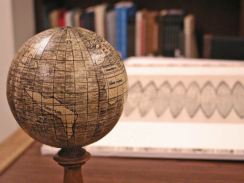
The map itself is cut into a series of shapes called gores, that allow it to be formed into a sphere or globe about the size of a softball. Experts believe the printers originally produced 1,000 of them. Only four are known to survive.
The map, for the first time, projects the Earth using a full 360 degrees of latitude, as opposed to the hemispheric depiction that had become the norm, Ragnow says.
"He put the new information and the more accurate information -- what he perceived to be the more accurate information -- on the globe, because he believed the globe was a more accurate way to represent the Earth," Ragnow says.
The library's namesake, James Ford Bell, purchased the map in 1954 after four years of negotiations. He didn't disclose what he paid, but Ragnow says, based on a similar document auctioned off in 2005, the Waldseemuller map has a value well over $1 million. She says even though it's normally kept in a secure vault, anyone can request to see it.
"We let them get close to them because we want them to understand that they're real. They're not something on television that you can't touch. They're not something in a museum," says Ragnow. "And that's one of the things that distinguishes a library -- even a rare books library -- from a museum, is you can come in and use the materials. They're not behind glass. They're not tucked away where you can't look at them. You can come in here and use the materials."
On Monday, the first day of the exhibition, history buffs and curious members of the public trickled in to stand inches away from the fragile artifact. One of them was U of M freshman Tim Dubis, who originally envisioned something grander.
"I really expected it to be a little bigger. It's really kind of small," says Dubis. "I was expecting a full-size cartography map."
Still, Dubis thought the world-changing map in such close proximity is at least worth some time on his lunch break.
"It's pretty impressive it managed to stay together for so long."
The Waldseemuller globe gores map, as well as other documents from the time that help put the map in context, will be on display at the library until the end of the year.

