

Rural areas new focus of Red River Valley flood fight
Go Deeper.
Create an account or log in to save stories.
Like this?
Thanks for liking this story! We have added it to a list of your favorite stories.
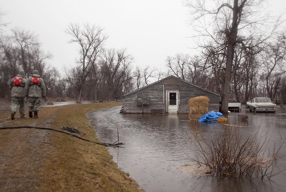
The Red River continues to fall in Fargo-Moorhead, but overland flooding is surrounding hundreds of rural homes and farms.
The high water in the Red River is forcing some tributaries to back up in rural areas.
Get the latest flood news on our flood blog.
Turn Up Your Support
MPR News helps you turn down the noise and build shared understanding. Turn up your support for this public resource and keep trusted journalism accessible to all.
Fargo Mayor Dennis Walaker said he won't relax until the river falls below sandbag dikes and earthen levees.
Walaker said it appears the city will have little flood damage. However he said a lot of damage is occurring in rural areas around Fargo.
"Sixty miles of roads in our county that are impassable right now. That's huge," Walaker said.
Walaker said Fargo has offered sandbags and other assistance to rural communities.
Clay County Sheriff Bill Bergquist said the county has not had to evacuate any residents, but travel is very difficult.

"Things are getting a little better," he said. "The river is dropping a little bit, but the overland is still causing some problems."
North Dakota National Guard troops rescued an 87-year-old man north of Fargo Saturday after the sandbag dike around his home failed.
Highway 75 is closed in Minnesota near Georgetown and Halstad. In North Dakota, Interstate 29 is flooded for several miles north of Fargo. It is closed from Harwood to Argusville, as of 5:30 p.m. Closing I-29 means a 40-mile detour for traffic.
National Weather Service meteorologist Jim Scarlett said weekend rains will keep floodwaters high.
"So we're still looking at high water for awhile and the threat is not over although it appears to be subsiding," Scarlett said. "But certainly the rainfall is not a good thing for especially the outside areas that are just overland flooding. It's going to prolong it."
Scarlett said the Army Corps of Engineers will likely start releasing water from Lake Traverse on the South Dakota, Minnesota border this week. That will also prolong flooding on the Red River.
The National Weather Service said high winds this afternoon could raise one to two foot waves in flooded rural areas. The wave action could erode roads and levees.
"So anybody with both clay and sandbag levees, temporary type structures, it's a tenuous time frame with rain occurring and wind occurring," said NWS meteorologist Greg Gust.
NATIONAL GUARD ON PATROL
In Fargo and Moorhead, National Guard troops are still monitoring levees holding back the river.
Lt. Col. Mark Wiens says 218 Minnesota Guard members are deployed in Clay County. They are patrolling levees and staffing teams to respond to any leaks.
Wiens said with rain falling and the river still high, levee patrols are critical.
"Within Moorhead over the last 24 hours we've had two such incidents where our patrols were able to identify what were small leaks that city engineers were able to come and make a determination and make immediate corrections," Wiens said.
Wiens said the Guard expects to stay in Moorhead until late this week.
The National Guard will also send troops to Oslo on Monday as floodwaters rise and cut off access to the community north of Grand Forks.
The NWS said Sunday that the river reached a preliminary crest of 38.75 feet at 6:15 Saturday evening in Fargo-Moorhead. The river stage was 38.56 feet Sunday morning.
(The Associated Press contributed to this report.)

Dear reader,
Your voice matters. And we want to hear it.
Will you help shape the future of Minnesota Public Radio by taking our short Listener Survey?
It only takes a few minutes, and your input helps us serve you better—whether it’s news, culture, or the conversations that matter most to Minnesotans.
