New Fargo-Moorhead flood maps to hit more homeowners' wallets
After years of work, a new Federal Emergency Management Agency flood map takes effect Tuesday in Moorhead, and a new map is in the works for Fargo.
The new maps increase the size of the floodplain in both cities and affect the cost of flood insurance for homeowners and future development for cities. The new maps will likely cost Fargo-Moorhead residents who live near the Red River millions of dollars.
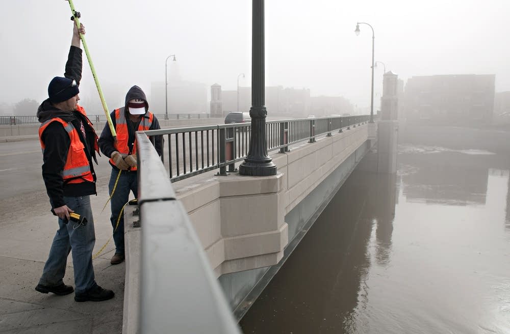
Moorhead City Engineer Bob Zimmerman is just glad the new flood plain map is finally official.
The current FEMA flood map update for Moorhead and Clay county started more than a decade ago. For the past several years the city has been using two maps for planning and zoning. The official map, and the preliminary new map.
Create a More Connected Minnesota
MPR News is your trusted resource for the news you need. With your support, MPR News brings accessible, courageous journalism and authentic conversation to everyone - free of paywalls and barriers. Your gift makes a difference.
"From our perspective, we've been in limbo here for so long with these new maps," Zimmerman said. "This sort of brings some certainty, at least to the near-term future as far as flood plain management."
That new map lets him tell developers exactly where then can build or how much lots need to be raised to be out of the floodplain.
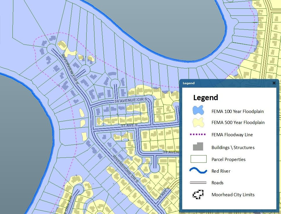
FEMA regularly updates flood maps to reflect changing flood risk. The new map doesn't have a huge impact in Moorhead, in part because the city is on higher ground than Fargo, and because Moorhead has been buying and removing flood-prone homes near the Red River.
Zimmerman said about 250 Moorhead homes are in the new flood plain, not much of a change from the old map, and the city plans to buy still more homes if a state bonding bill provides funding.
NO NEW MAP YET FOR FARGO
Across the Red River in Fargo it's probably going to be late next year before the new FEMA flood map is finalized. That's because each side of the river is a different FEMA region, working on a different timetable.
Fargo City Engineer April Walker has been carefully studying the proposed new floodplain map.
"We have about 400 to 500 homes in the current flood plain. That is going to go up to about 3,000 within the city," Walker said.
The land in Fargo is lower than in Moorhead, so the effect of a new flood map is more dramatic. Three-thousand Fargo homeowners will have to buy flood insurance when the new map takes effect.
Future development of vacant lots will also be limited if they are in the flood plain. Walker said those homes can only be removed from the flood zone if the city builds permanent FEMA approved levees.
"We have done an analysis to determine what is it going to take if we want to build completely out of the new flood plain," Walker said. "The cost to Fargo to do that would be about $247 million."
Fargo city leaders are asking voters to approve a half-cent sales tax in June, to pay for FEMA certified levees.
But as she plans those levees, Walker is already thinking about the next FEMA flood map.
"It's going to happen because FEMA recognizes that in the effort to remap they did not go back and look at hydrology," she said. "They used the same hydrology that was used for the previous maps. Well, since then we've obviously had a string of flood events."
OLD DATA LESSENS IMPACT
FEMA is using old data to make the new maps. None of the record floods of the past 10 years are part of the data.
The new FEMA maps raise the 100-year flood level by about a foot. If they had used the latest data from the Army Corps of Engineers, the level would have been about 3 feet higher.
But FEMA Regional Engineer Nancy Steinberger in Denver said FEMA is using a 2002 study for the new maps. She said it's hard to keep up with rapidly changing data.
"There's a lot of activity right now in the Fargo-Moorhead area related to projects the Corps is proposing," Steinberger said. "They have a lot of active ongoing work. Because we started this project in 2001 we're continuing forward with the information we have right now.
Steinberger said FEMA likely won't consider another flood map update until they see how the proposed $1.8 billion Red River flood diversion progresses. The diversion would significantly reduce flood risk for the two cities.
If the diversion isn't funded by Congress, the next flood map update, perhaps a decade from now, will be much more painful for Fargo and Moorhead because thousands of additional homes would be in the flood zone.
