Contaminated food warnings issued; Coast Guard rescues Thomson residents
From MPR staff and wire reports
DULUTH, Minn. — All 588 residents of Barnum in northeast Minnesota were "completely evacuated" on Friday afternoon due to flooding.
That evacuation comes on the heels of a week of flooding in northeast Minnesota that officials estimate has caused over $100 million in damage.
HELICOPTER RESCUES
Create a More Connected Minnesota
MPR News is your trusted resource for the news you need. With your support, MPR News brings accessible, courageous journalism and authentic conversation to everyone - free of paywalls and barriers. Your gift makes a difference.
The U.S. Coast Guard is using resources from around the Great Lakes to help rescue flooding victims.
Coast Guard Lt. Adam Saurin, in Sault Ste. Marie, Mich., says the agency brought in an HH-65 Dolphin helicopter from Traverse City, Mich., to rescue five people from the raging water in the small community of Thomson, southwest of Duluth, on Thursday night. Floodwater prevented residents of the St. Louis River community of 160 from leaving their homes.
Saurin says a Coast Guard airboat from Duluth and another from Bayfield, Wis., helped rescue 12 people from the Fond du Lac neighborhood in Duluth. He says another airboat from the Detroit area is on its way to flood-affected areas.
Northeast Minnesota Floods: The Latest
• Photos: Duluth, northeast Minnesota awash
• Photos: Gooseberry Falls at full trottle
• Photos: North Shore residents shocked by deluge
• Photos: Moose Lake fights the flood
• Story: Tourism-dependent region worries
• Story: Duluth turns to FEMA for help
• Story: Cell phone, 911, cable out in Arrowhead
• Story: Frantic search for loose zoo animals
• Map: Duluth, North Shore flood zone
• Closures: Highways, Duluth streets, state parks
MOOSE LAKE BANDS TOGETHER
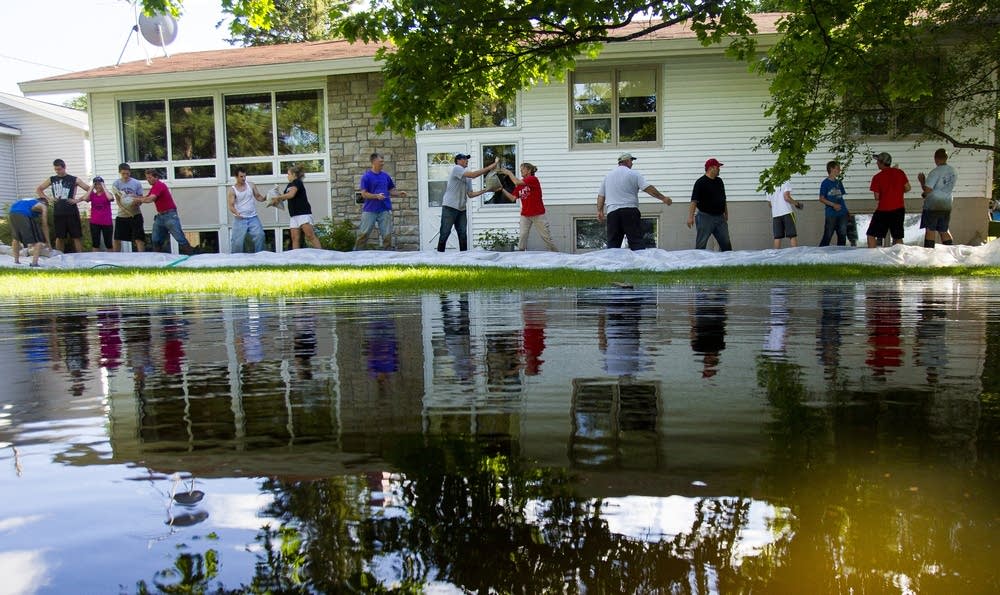
At one point during the day, the water was rising about an inch every hour in the town Moose Lake, a community of 2,700 people near the Moose Horn River and some 40 miles southwest of Duluth.
Resident Joe Mohelsky says his house is "pretty much underwater," after the water rose 4 feet in less than 24 hours, covering most of his lake-side property with murky, debris filled water. About 8 inches surround his 2,500 square foot log house. Sand-bags have helped, but so far there's about an inch of water inside.
Mohelsky says when he purchased the property, the government required that he also buy flood insurance, because it was in a federal flood zone. But Mohelsky appealed it.
"We got a waiver on our flood insurance, which was probably about 12 years ago. We never, ever expected it to be to these levels," he said. "Flood insurance is very expensive. It was actually more than our regular home owners insurance was. So it's a chance you take and we gambled and we lost this time."
FEW CARRIED FLOOD INSURANCE
Homeowners dealing with the aftermath of the flooding are about to confront a horrible reality: They'll have to pay out-of-pocket for much of the damage to their homes.
Only about 100 homes in Duluth carry flood insurance, available through the National Flood Insurance Program. That means most of the damage that hit Duluth property owners this week is uninsured: Only 111 flood insurance policies were in force in Duluth and only 12 policies were sold in Cannon Falls this year, according to statistics available on the website of the National Flood Insurance Program.
Some homeowners have an insurance rider that covers water damage from sewer or drain backup, coverage that typically costs less than $50 per year, the insurer group says.
Flood coverage, though, is still rare in much of Minnesota. Unlike folks in the Red River Valley who live each year with the prospects of flooding, it hardly ever happens in Duluth. Until this week, having no flood coverage didn't seem like a gamble.
FREIGHT LINE OPEN AGAIN
Freight rail lines in Northeastern Minnesota are re-opening after the flooding.
Canadian National Railway runs more than 25 trains a day between Duluth, the Iron Range and International Falls.
CN spokesperson Patrick Waldron says crews have spent the past 48 hours repairing track damaged by the rain and flash flooding: "The rail lines that have been affected have been repaired, and trains are running again, not all of them certainly, it will take a while for the service to return to normal but that process is already underway. It began this morning and we're looking forward to resume full service as we head into the weekend," he said.
Waldron says crews are still working in the Duluth area around the Duluth dock but most of the activity is starting up again on the Iron Range.
DULUTH NEIGHBORHOOD STILL HAZARDOUS Duluth officials announced Friday that they're opening up a 24-hour community command post at Highway 23 and 130th Ave. W. in Duluth. The post will provide services like meals and water. Fond du Lac esidents will be able to drive as far as the command post, then will be able to walk into the neighborhood during daylight hours after they check in with an ID.
Duluth officials say it's still not safe for evacuated residents to return to their homes in the low-lying Fond du Lac area.
The neighborhood still has standing water.
Damage assessment teams from the Federal Emergency Management Agency are expected to be in the area next week to start tallying the damage to public infrastructure in 14 counties and one Indian reservation.
The numbers so far are staggering -- more than $100 million in infrastructure damage in the region, and at least 1,400 miles of St. Louis County roads will need repair, not including about 50 miles of roads in Duluth.
The preliminary damage estimates from flooding in the region are huge. St. Louis County reports at least $30 million in damage to more than 1,400 miles of roads. The Minnesota Department of Transportation says state highways need at least $20 million in repairs. Duluth Mayor Don Ness estimates the city's damage between $50 million and $80 million.
"It has overwhelmed our stormwater system, it has damaged our street system, our parks and trails have been decimated by this storm," the mayor said.
Ness says Gov. Mark Dayton assured him he will ask the President to grant a Presidential Disaster Declaration.
EYEWITNESSES RECALL ZOO CHAOS
As heavy rain flooded the Lake Superior Zoo Tuesday night, no one was there to notice that a polar bear and two seals had escaped from their enclosures.
The zoo's response to the flood took hours and left some residents wondering it was safe to leave their homes. Zoo keepers did not realize the facility was flooded until they received a call about a seal in the middle of a nearby road.
That's because, unlike the Minnesota Zoo and the Como Zoo, the Lake Superior Zoo does not have 24-hour security guards, cameras, or motion detectors.
The U.S. Department of Agriculture, which regulates zoos, does not require zoos to provide 24-hour security. Officials at the Duluth zoo said the flood was unpredictable and they had planned to install security cameras later this summer.
WORRIES ABOUT TOURISM
Some area businesses and officials are worried about how the damage will affect the region's $800 million tourism industry.
On Thursday, floodwaters from Otter Creek continued to flow across Highway 210, the main downtown street in Carlton, Minn. About 15 miles south of Duluth, it's one of the gateway communities to scenic Jay Cooke State Park.
Hit hard by flooding, the park is closed, and probably will be until mid-July. Roads and bike trails inside the park were reportedly washed out. The park's famous swinging bridge was severely damaged.
Carlton Mayor Leola Rodd said those are some of the things that draw tourists to her town. Now she's worried those visitors won't be back for a while. Safety Warnings Fruits and vegetables planted in flood-damaged areas of northeast Minnesota could be contaminated and should not be eaten, the Minnesota Agriculture Department is warning. "The risk of contamination is generally considered highest for food crops that were submerged in water overflowing from rivers or streams," department officials said in a statement. Fruits and vegetables from areas impacted by flood waters "may be considered adulterated and should not be used for food," the statement continued. "If the part of the plant used for food came into contact with contaminated flood water it should not it should not be harvested for human consumption."
FLOOD PATH MAP
The map below shows the area currently affected by flood waters, and areas that have an elevated risk of flooding. The data comes from the National Weather Service and the Minnesota Department of Natural Resources.
