Severe hurricanes may become more common along the East Coast

Superstorm Sandy cost billions of dollars, just in lost economic activity, when it hit the East Coast. It knocked out power to more than 8 million homes. So it's alarming to consider the conclusion of a Danish researcher: that big storms may strike the eastern United States more and more in coming years. On Thursday's Climate Cast, Kerri Miller and MPR News' Chief Meteorologist Paul Huttner talked about those findings and the outlook for the coming tornado season. Here's an edited transcript of their conversation:
Kerri Miller: There's interesting research out of Copenhagen that says our warming climate may affect the number of hurricanes we have and the intensity of them.
Paul Huttner: The bigger part of the story is the intensity. This is another little piece in the climate puzzle that we start to piece together. I think this is an important paper. The oceans are a little underemphasized, perhaps, as a part of climate change. We always talk about a warmer atmosphere; the oceans are warming as well, and they're probably the biggest factor in determining the intensity of hurricanes, specifically the temperature of the oceans. This study went through 90 years of East Coast storm surge records. When you compare them with global temperatures, that turns out to be the best predictor of hurricane activity. What the study is saying is that Katrina-like storms will become much more frequent, maybe two to seven times more frequent. Instead of every 25 years, every five years we could see a Katrina-sized storm. That could be significant as we go forward.
Miller: When we talk about Katrina, let's remember it was the way it built and spread, widened in the days before it hit New Orleans, and then the intensity with which it hit that city.
Create a More Connected Minnesota
MPR News is your trusted resource for the news you need. With your support, MPR News brings accessible, courageous journalism and authentic conversation to everyone - free of paywalls and barriers. Your gift makes a difference.
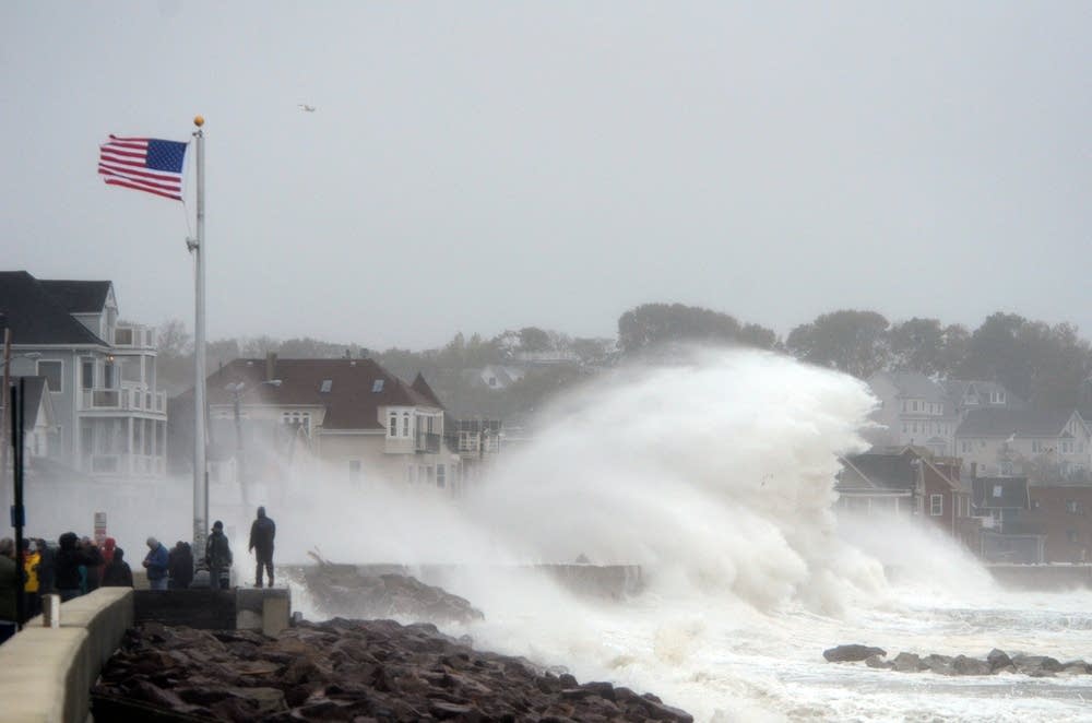
Huttner: Even before that, you may remember, it flared right before it hit the south part of Miami, ripped through there, across the gulf, flared again, a much larger storm by then. One of the things I've noticed, and we saw this with Sandy, it's not just that the oceans are getting warmer, they're getting warmer at higher latitudes. That feeds storms, that keeps storms stronger as they move out of the tropics and into places like New York City and New Jersey. If we keep seeing these ocean temperatures rise, we may have more situations like a Hurricane Sandy that we saw last fall.
Miller: Is this because the oceans are trapping carbon that's being emitted through greenhouse gases?
Huttner: That could be part of it, but the bigger picture is that the oceans store heat. The oceans heat and cool more slowly than the atmosphere, so once you get a very hot summer, you get a hotter ocean. It takes a much longer time for that heat to dissipate than it does in the atmosphere. That keeps the oceans warmer in the fall, potentially warmer in the late summer, and that can fuel more intense hurricanes.
Miller: This is something they're watching closely at the poles?
Huttner: It is. This is another connection that I find fascinating. This Arctic amplification, the warmer Arctic Ocean, there's evidence it slows down the jet stream, makes it wavier and loopier, and when that happens we get unusual tracks of hurricanes and weather patterns. That's another climate change tie to Hurricane Sandy that may have occurred. We have this unusually loopy jet stream; instead of pushing this storm out to sea, it sucked it back in to the Jersey Coast.
Miller: Are you seeing the greatest unusual patterns in the jet stream in the summer seasons or winter seasons?
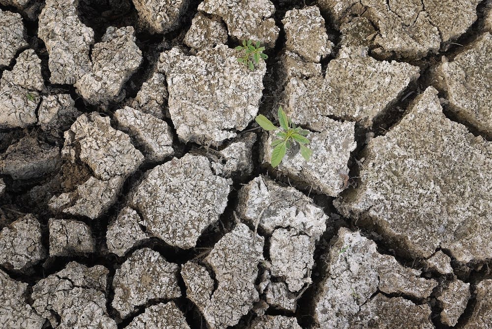
Huttner: I'm not sure that there is a definite seasonal signal there. We're seeing it a little bit in both. Last summer's drought was another example where the jet stream just stuck in a blocking pattern, this big ridge just sat over the central U.S. all summer long, and we baked and we cooked and we baked. A slower jet stream means less frequent weather changes. It means patterns get stuck.
Miller: You just mentioned the drought. Some of the information we've been reading up on this week says that droughts are actually good news for a lighter tornado season.
Huttner: One of the benefits of drought, if there is one. We've seen a lot of variability in our tornado seasons over the last two years. Remember 2011? One thousand, six hundred and ninety tornadoes in the U.S. Deadliest year since 1953. Joplin, Tuscaloosa, those remarkably deadly tornadoes. Fast forward to last year, 939 tornadoes. A below-average number and a below-average fatality count. Why? We were in drought, the jet stream was stuck. If you don't have thunderstorms, you don't have rain, you don't have tornadoes. One of the links we may be seeing with climate change, we have higher variability from year to year in our weather and that would include tornadoes as a logical consequence. There are few if any links to climate change in overall tornado frequency so far, but perhaps some evidence of this higher annual variability.

Miller: What might that mean for some areas of the country? I used to live and work in Oklahoma, that's Tornado Alley. But they have been suffering from an extended drought for the last several years. Might we see the areas of the country affected by tornadoes move farther north or out?
Huttner: Exactly right. That's one of the trends we have seen. I ran some numbers a couple of years ago that showed that for the first time in that very active tornado year of 2010, here in Minnesota we eclipsed Oklahoma in the number of tornadoes in a year for the first time ever. It's never happened before. Was that a fluke? Too early to tell. But there is some evidence that Tornado Alley is moving north. Again, this fits with the overall climate puzzle. As the planet warms, the jet stream shifts north seasonally. The jet stream is where the action is, that's where the contrast is, where the storms are. If that jet stream is riding up over Minnesota, the Upper Midwest instead of Kansas and Oklahoma, you would expect the tornadoes would shift north as well.
Miller: When do you get a sense of what kind of tornado season it's going to be? I'm trying to remember when severe weather preparedness season happens. Is it later in March?
Huttner: It's usually the first week of April around these parts. It's different in different parts of the country. Here's what I'm seeing this year: One factor that may drive a more intense tornado and thunderstorm spring is this snow cover. That keeps us cold at a time of year when we should be warming a little more rapidly. To the south, there is no snow, they're warming quickly. They've had days in the 60s, 70s already. That creates a bigger temperature contrast from north to south. Bigger temperature contrast, more strong storms. There are some lines of thinking that this could be a more active, severe storm and tornado season this spring.
Miller: I know we'll talk about preparedness at another time, but what should we be thinking about as we prepare for severe weather?
Huttner: Have multiple lines of communication. Multiple safety nets for getting your warnings. Your NOAA weather radio, your smartphones. On new smart phones, warnings are coming automatically. That's a good thing. TV, radio obviously. Stay situationally aware. Have a plan for once it hits. What are you going to do, where are you going to go? Simple common sense things that can make a big difference once the weather hits.
