Drone video analysis program is first of its kind

For much of the last decade the U.S. military has relied on unmanned aircraft to perform some of its most perilous missions: capturing video from war zones to provide intelligence for troops on the ground or track terrorists.
In the coming decade, drones might also perform a wide variety of civilian jobs such as collecting video for agriculture or emergency management.
Many of the analysts who scrutinize the images transmitted by such drones have received their training in the military. But that's changing.
Northland Community and Technical College in Thief River Falls now offers a one-year Imagery Analysis certificate, the first of its kind in the nation, and a two-year associate's degree in Geospatial Intelligence Analysis.
Create a More Connected Minnesota
MPR News is your trusted resource for the news you need. With your support, MPR News brings accessible, courageous journalism and authentic conversation to everyone - free of paywalls and barriers. Your gift makes a difference.
The program teaches students how to use a variety of computer systems that could prepare them for work with the military or a future civilian job.
As a result, the next generation of analysts might well be represented by 19-year-old Emily McGrath.
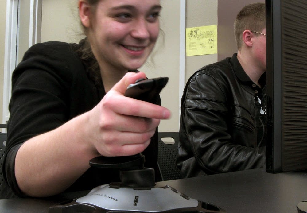
In a recent training session, McGrath used a computer-simulated video to fly over a tiny island off the coast of Spain. As she manipulated a joystick, the landscape unfolded on the screen in front of her.
"I kind of view it as a huge I spy hunt," said McGrath, who graduated from Thief River Falls High School last year. "You could look at this imagery for like hours and hours and still not find everything that you need to. It's fun, but it's also nerve-wracking."
Imagery analysis is part of a new drone focus at Northland Community and Technical College. Two years ago the school started an unmanned aircraft maintenance training program.
The new program presents students with a challenging curriculum. They learn complex geospatial computer programs that require math skills. They also hone writing skills and study privacy laws.
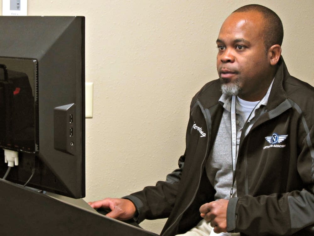
When the first class started last spring, there were 52 students. Only 21 remain, but instructor Sterling Williams expects most of them to complete a two-year year degree next fall. Many of the students are recent high school graduates. But a few have college degrees. Williams said a couple of students hold doctorates.
Trained as an imagery analyst in the U.S. Army, Williams has 20 years of experience working in military and defense industry jobs.
Williams, who helped create the program at Northland, said that by the time students complete it they will have a wide range of skills that put them at the level of a veteran military analyst.
McGrath and other students have another talent they didn't learn in school - a facility with video games.
"A lot of students that excel the most, they game a lot," Williams said. "They play a lot of video games. It's easier for them to learn to see the ground. It's easier for them to learn to see things that are out of place in an image because that's what they've been trained to do by playing video games."
Although their course of study is relatively new, the students could be helped by the federal government, which is developing a process to certify imagery analysts.
Williams, who said it's critical to have trained professionals, equates their skills to that of police officers who use radar guns. If the officers aren't properly trained, their use of the tools can't be trusted. He said all students who complete the NCTC program will meet federal standards.
After the students graduate, the military likely won't be their only option. The Federal Aviation Administration is developing rules to regulate how unmanned aircraft share the nation's airspace and once they are in place a number of fields could use them. Drones carrying sensors and cameras could be used in precision agriculture, emergency management or jobs that have yet to be created.
"Wherever you have a sensor you're going to need someone who operates that sensor and can translate the data the sensor collects into an answer to a question," Williams said.
But for the moment, many of the jobs are in the military. That's why Evan McCullough, who grew up in the nearby town of Newfolden, is leaning toward initially pursuing a military job.
McCullough expects most job opportunities to be overseas in countries with more relaxed standards for drones, or with the federal government. But he is interested in using drones in precision agriculture if that industry ever takes off.
Imagery analysis demands sharp attention to detail, with work that can be repetitive. But McCullough said there is enough uncertainty to keep him focused.
"I like the fact that you come in probably day to day not knowing exactly what might happen," he said. "There's always that element of 'something big might happen, and I might catch it."