

Across Minnesota, rising waters pose hardships for farmers and residents

Go Deeper.
Create an account or log in to save stories.
Like this?
Thanks for liking this story! We have added it to a list of your favorite stories.
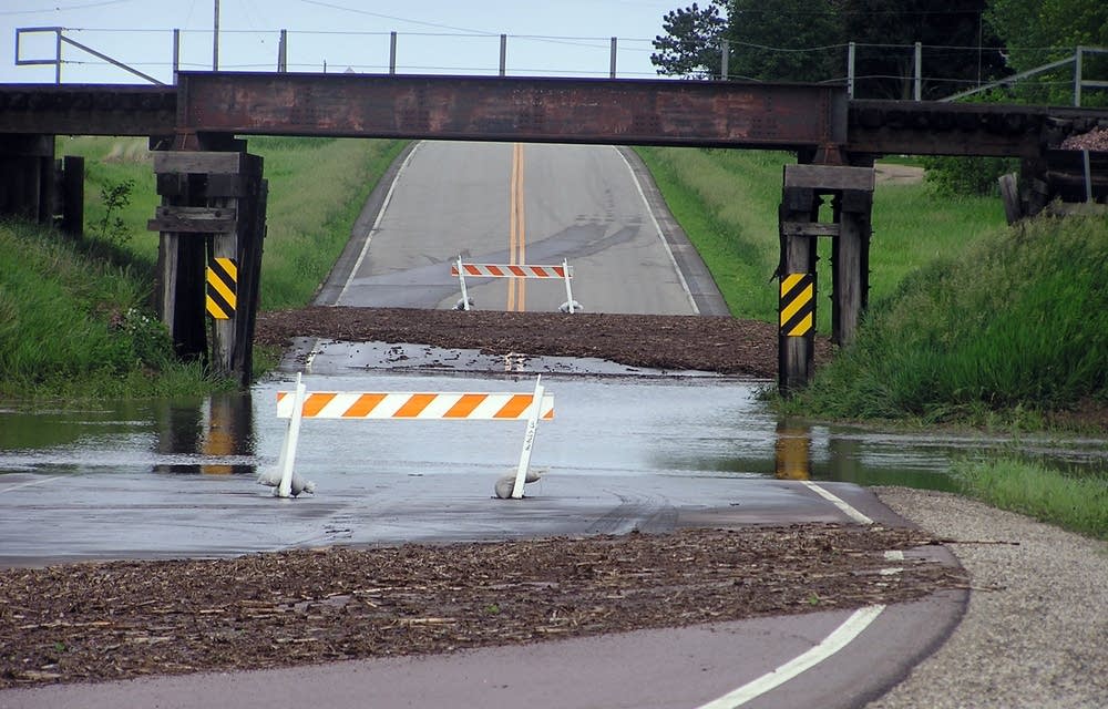
Farm fields became ponds and roads flowed like rivers this week as downpours in Minnesota soaked saturated ground, damaging crops and threatening homes from the Iowa border to International Falls.
Daily rains have been particularly disheartening for farmers in southern Minnesota, where since last weekend some areas have had nearly a foot of precipitation. The hardest hit spots are still dotted with pools of standing water.
• More: Epic flood threat and severe risk continue
"We had a constant rain all day Saturday and by Sunday morning we had 5.8 inches in the rain gauge," Rock County farmer Lyle Rollag said Tuesday. "Then yesterday evening we ended up with about 3.3 inches of more rain."
Turn Up Your Support
MPR News helps you turn down the noise and build shared understanding. Turn up your support for this public resource and keep trusted journalism accessible to all.
The deluge put about 25 acres of Rollag's corn and soybeans under water and nearly cost him some cattle that were in a pasture when the storms hit last weekend.
"That pasture happened to have a creek that went through it and that was well out of its banks," Rollag said.
The cattle ended up standing in four feet of water, but the current washed out the fence that penned them in. When that happened, some 64 cows and calves were able to swim to safety.
Rollag said the heavy rains eroded soil from his fields and others in the region, sometimes leaving gullies behind where the rushing water carved into the land. Hail also damaged crops in southwest Minnesota.
Michael Wagner, who farms near the town of Rushmore, Minnesota, said the storms harmed crops in a roughly 15-mile stretch of Nobles County near Worthington, Minnesota.
"There's hail damage from just maybe some stripping of the leaves on the corn to complete destruction," he said.
Wagner said farmers will be watching the weather over the next week, hoping for drier conditions. If the weather improves, he plans to replant some soybean fields next week.
Wagner said there's nothing he can do for his damaged corn as it is too late to replant.
But there may be hope for some of those flooded fields. University of Minnesota Extension agronomist Jeff Coulter said it all depends how fast the water recedes.
"If that water is able to recede within a day or two, the corn should start to regrow within about three to five days, we should see some new leaves coming out of the plant," he said.
But Coulter said if the water stays longer than that the corn plant will die.
Weather forecasts are calling for continued chances of rain this week, but then it may dry out some. Coulter said while southwest Minnesota was the hardest hit, other parts of southern Minnesota also experienced heavy rains.
The downpours over the last few days brought with them more than just flooding rains and damaged crops in the southwest part of the state. For Rollag, they also delivered a large dose of irony.
"We couldn't seem to buy a rain and now we can't seem to shut it off," he said.
A month ago, Rollag's land in Rock County had drought conditions. Since then he's seen too much rain.
"We've had probably 12 to 5 inches since Memorial Day," he said. "Nature can be fickle."
Meanwhile, residents of northern Minnesota also were coping with drenched ground.
In International Falls, Gov. Mark Dayton met Tuesday morning with Koochiching County officials and toured flooded areas.
Dayton was ferried across 200 yards of flooded Route 11 to see sandbagging efforts at the Loman, Minnesota, Fire Station, which sits near the confluence of the Black and Rainy Rivers.
The station is one of 60 to 75 structures surrounded by sandbag dikes along the Rainy River and Rainy Lake shoreline according to Koochiching Sheriff's Department Capt. Jon Froemke.
Froemke said he is not aware of anyone who lost their home, but one home on the Rainy River a dozen miles west of International Falls is completely surrounded by sandbags and feet of water.
"They're running machinery through 5 feet of water just to get to the house," Froemke said.
The situation won't improve for at least a week.
Torrential rains over the weekend forced waters to record levels. The Rainy River set yet another record Tuesday, this time under clear sunny skies.
According to a U.S. Geological Survey gauge at Manitou Falls, the Rainy River has climbed another inch since Monday, setting yet a new high water record. Previous flood records on the river were set back in 1950.

Steve Buan, a hydrologist at the National Weather Service said the river will likely keep climbing, even as the sun beats down.
The long slow rise of flood waters, he said, is somewhat unique to the northern border. The massive Rainy River watershed is packed with tamarack bogs, which hold water like sponges, slowly releasing it downstream.
Typically the bogs are a good thing, easing spring melts through the river system with little if any flooding. But they do have their limits. This year spring melts from the snowy winter filled the bogs just as heavy rains hit the area for weeks at a time.
If the winter had been less snowy, or the rains less intense, Buan said the bogs would have handled the water.
"But it's all come together here," he said, "with the large runoff going right into the heavy rainfall."
As a result, the bogs create a distinctly negative effect. Buan said they're releasing water downstream that will create a steady rise for days.
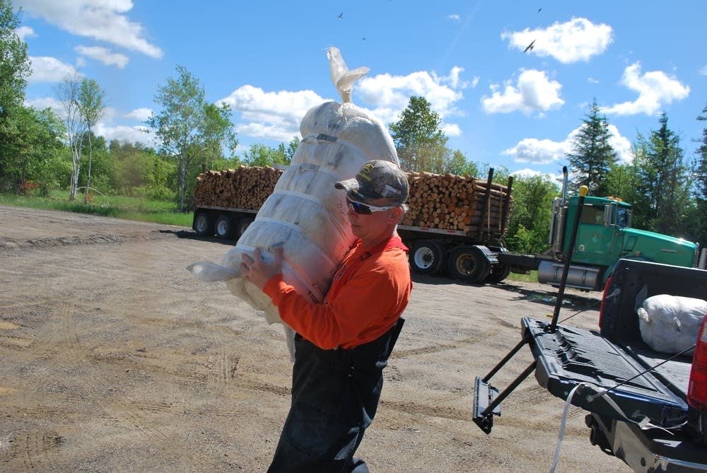
That's not good news for people depending on the 100,000 sandbags already holding flood waters at bay. Sandbags are a temporary measure, not meant to hold back water in the long term.
If the Rainy River stays at record levels through the weekend as Buan expects, sandbag dikes could start to fail.
There's also more rain in the forecast. Thursday and Friday could net northern Minnesota another 1.5 inches of rain.
Froemke said that much rain would push Rainy Lake up more than a foot and the river a few more inches over the next week.
As the water rises, many more homes will be threatened and exponentially more sandbags will be needed to raise existing walls.
Froemke said 100,000 sandbags at 75 structures are just the beginning. Anderson said the sheriff's department was considering a plea to the National Guard, but Froemke said the Guard has not been called.
Despite exhausted volunteers and possibly worse conditions to come, emergency workers are just sticking to the current plan, Froemke said. "We're going to take it day by day get what we can done."
