Rains bring mudslide outside U hospital; Dayton declares emergency in 35 counties

Updated 10:53 p.m.
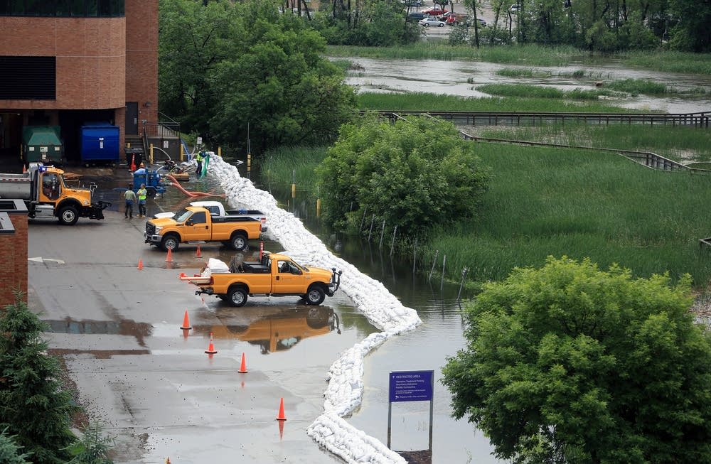
A building on the University of Minnesota's Fairview Medical Center campus sat perched above a large mudslide and the Mississippi River Thursday night, the latest evidence that a week of rain in Minnesota has pushed Twin Cities over-saturated ground to its limits.
The cliff collapsed in a mudslide above the West River Parkway, on the west bank of the Mississippi, and into the river.
Raymond Cruz, deputy chief for engineering and logistics for the Minneapolis Fire Department, said no one was in the area at the time.
Create a More Connected Minnesota
MPR News is your trusted resource for the news you need. With your support, MPR News brings accessible, courageous journalism and authentic conversation to everyone - free of paywalls and barriers. Your gift makes a difference.
"We had the city's building engineer down here and he's found everything to be safe," he said.
The parkway is closed off from the Franklin Avenue Bridge to 4th Street.
Cruz said cleanup crews may secure the area in the morning.
Medical center spokesperson Jennifer Amundson said the slide occurred across the street from one of the hospital's office buildings. No patients or patient-care areas of the hospital were evacuated or affected by the slide, she said. She wasn't aware of any other evacuations to the hospital or its surrounding buildings.
The situation is stable, Cruz said, as long as heavy rains hold off.
• Live updates: Road closures, rain forecasts, photos and more
• The Updraft: Wettest year ever; flood threat continues overnight
• Minnesota road closures: MnDOT's updated list
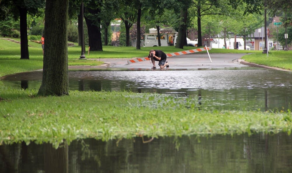
• Photos: It just keeps raining. And raining.
• More: Deluge doesn't end groundwater concern
• Across the state: After the rains, grueling cleanup on the farm
35-county state of emergency
With storms and flooding triggering havoc around Minnesota — and more rain on the way — Gov. Mark Dayton on Thursday declared a state of emergency in 35 counties and ordered Minnesota National Guardsmen to aid relief efforts.
The emergency notice mobilizes state aid to counties and towns fighting the flooding. There was plenty of evidence across Minnesota Thursday that people could use the help.
Nearly a year's worth of rain has fallen on the Twin Cities in the first six months of 2014, the National Weather Service said Thursday.
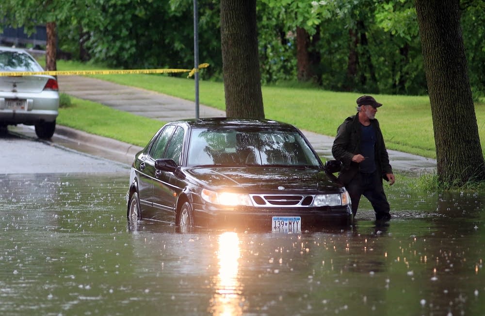
The Twin Cities metro and parts of western Wisconsin spent most of Thursday under a flood warning. By late Thursday state officials were warning of the flood waters' potential health risks, including contaminated wells.
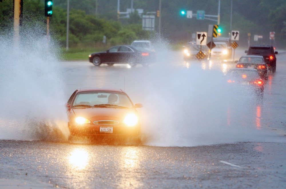
The rain ebbed Thursday afternoon across the Twin Cities, but the weather service cautioned that more storms are likely from late afternoon into early evening. More flooding is expected and the saturated ground together with wind gusts could bring down trees across southern Minnesota and the Twin Cities.
The Minneapolis-St. Paul International Airport reported flooding caused some flight delays Thursday morning.
At noon Thursday, Xcel Energy said about 7,100 of its Minnesota customers were without power due to the severe storms. Roughly 2,800 are in the Twin Cities, nearly all in the western suburbs.
The break from rain this afternoon has allowed crews to restore power, and the utility said it expects customers to be back up by the end of Thursday.
Dayton is traveling to hard-hit Mankato and Owatonna today to assess flood damage and meet with emergency officials.
Flight delays, lightning strikes and a wet mess in the metro
Minnehaha Creek rose about a foot overnight. Lake Minnetonka, Minnehaha's source, set a new record at 930.77 feet above sea level Thursday, the highest since record-keeping began in 1906, the Minnehaha Creek Watershed District said.
In the west metro, washed-out roads and a damaged levee led the city of Carver Thursday morning to declare a state of emergency.
A landslide closed Minnesota Highway 13 between Interstate 35E and Cherokee Heights Boulevard in Mendota Heights, the Minnesota Department of Transportation reported at noon Thursday.
Fire officials say a lightning strike is the likely culprit for an incident that set three homes on fire in Lakeville Thursday morning.
In St. Paul, the fire department said a lightning strike caused a fire at Marshall Avenue home.
Parks and trails surrounding Minnehaha Creek in Minneapolis are flooded, along with Cedar Avenue, according to the watershed district. Houses in St. Louis Park and Edina along the creek have been sandbagging.
In Minneapolis, Burroughs Elementary School and a handful of other sites, mostly near Minnehaha Creek, have called the city seeking sandbags.
The Minnesota Department of Natural Resources announced that it will allow local governments to set up no-wake zones on lakes and rivers because of the high water.
Cities, counties and townships can enact up to 30-day no-wake restrictions if water is at a level that's threatening property. Usually, municipalities can only limit boat speeds for up to five days. If they decide to enact new zones, cities must notify the public and the DNR.
Around the Twin Cities, Lake Minnetonka, Prior Lake and portions of the St. Croix River are now under no-wake zones.

Broken roads, Guardsmen and sandbags across Minnesota
Heavy rains have pushed the Cannon River to the top of concrete flood walls in downtown Northfield and gawkers are making the situation even more dangerous, said Northfield Mayor Dana Graham. "People are lifting up their kids on bridges to look over them," he said. "Someone could easily fall in."
Northfield officials don't expect the river to rise high enough to spill into downtown, but the city has shut down three bridges to keep cars and pedestrians out of the way of emergency vehicles, Graham said.
Some parts of Minnesota have seen 3 to 5 inches of rain in the past 24 hours, including the Mankato area, where heavy rain Tuesday and Wednesday has already caused flooding and closed roads.
In St. Clair, southeast of Mankato, about 100 volunteers stacked sandbags Thursday to hold back the rising Le Sueur River.
Eight to 10 homes and St. Clair's post office are in danger of flooding, but the water treatment plant is safe, said city clerk Cathy Seys. The plant is protected by a berm built after the city was hit hard by flooding in 2010.
Flood worries were widespread across Minnesota.
Flood warnings were up in Big Stone, Lyon, and Traverse counties, in western Minnesota.
Flood damage caused Blue Mounds State Park in southwest Minnesota to close. The park, near Luverne, has seen more than 11 inches of rain since Saturday.
In northern Minnesota, flood warnings will continue until 4 a.m. Saturday in St. Louis and Koochiching counties. On Friday, 100 members of the Minnesota National Guard will begin sandbagging along the Rainy Lake shore to relieve exhausted volunteers.
Heavy rains have pushed the Rainy River past a 1950 flood record and thunderstorms predicted will add up to 16 inches of water into the lake over the next week according to engineers with the regional watershed board. Koochiching County Chairman Rob Ecklund said they've laid 150,000 sandbags and ordered 200,000 more.
As water rises sandbag dikes must be fortified all the way down the base. That takes a lot of sandbags, and some actual skills. Most citizens have never seen, or fought such a flood, but Guard members have training.
"If volunteers keep showing up," Ecklund said, "We'll probably keep them filling bags, and have the Guard actually building the walls."
Once the water does crest, it will take weeks to return to normal levels. Residents are settling in for another month of high water.
MPR News reporters Elizabeth Dunbar, Meg Martin, Tim Post and Laura Yuen contributed to this report.
Live updates: Roads, rain, floods, photos