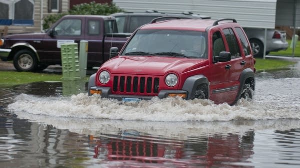
In historically wet year, this week's storms not quite 'mega'

Make no mistake, parts of Minnesota got a lot of rain overnight Wednesday. But it wasn't enough to classify it as a "mega storm event."
That designation is reserved for storms that dump 6 inches or more rain in 24 hours throughout a 1,000-square-mile area — about two average-size Minnesota counties. And within that region they'd have to see some areas measuring 8 inches.
The Wednesday night system was powerful enough to have the State Climatology Office buzzing Thursday morning as scientists there sorted through the data to get a sense of what happened.
A report of over 4 inches an hour at the Waseca airport drew particular scrutiny.
Create a More Connected Minnesota
MPR News is your trusted resource for the news you need. With your support, MPR News brings accessible, courageous journalism and authentic conversation to everyone - free of paywalls and barriers. Your gift makes a difference.
"That's exceptional," said climatologist Kenny Blumenfeld. "It's possible, but I think one of the things we'd like to see is what did the humans observe."
Blumenfeld and fellow climatologist Pete Boulay don't trust that figure, which came from an automated gauge.
Believe it or not, old fashioned metal cylinders that have been used for decades to measure rainfall are still the go-to technology. They're better than an automated gauge and better than radar.

Luckily, Minnesota has a robust network of observers who are trained to take rain measurements. Boulay often gets on the phone to collect data, which he then turns into maps showing which areas received the most rain.
Despite a lot of 6-and 7-inch readings from the northern Twin Cities suburbs to southeast Minnesota, it didn't take long for Blumenfeld and Boulay to determine this wasn't a mega storm event.
Still, it was close.
Minnesota got really good at measuring these storms in the early 1970s when a large and dense network of observers was first established, Blumenfeld said.
Since then, Minnesota has seen 10 mega events. Seven of them have happened in the past 15 years, including two this year.
"In some cases, a mega rainfall would be caused by a gigantic, slow-moving thunderstorm cell," he said. "More frequently what we see is a thunderstorm complex or a number of individual thunderstorm cells that repeatedly affect the same area."
Minnesota just had one of the wettest summers in history, and Blumenfeld says most of the moisture came from bigger storms.
"In that way, this summer resembles what we think of when we think of our changing climate, even if it's actually in response to something else," he said.
It's tough to tease out a climate change trend just from one season. These things are complicated.
"There's a lot of what we call noise, or chaos in the system," said Peter Snyder, a University of Minnesota climate scientist.
His team has researched the low-level jet stream — the ribbon of air that brings moisture to Minnesota from the Gulf of Mexico. Lately, August and September have been dry, making him wonder if this year's late summer heavy rains were anomalies rather than a sign of what's to come.
Still, he says climate change could be influencing those flooded streets and basements in another way: in a warming climate, the atmosphere has the capacity to be wetter.
"Maybe the setup wasn't climate change, but maybe the moisture capacity and the energy capacity in the atmosphere was greater because of climate change," Snyder said. "So the same setup 30 years ago versus now is going to produce more rainfall now."
University of Minnesota Extension climatologist Mark Seeley says the increased frequency of mega rains is disturbing. He says no one would have predicted the state would see two, almost three, megastorms this year.
"I was shocked, and I don't know when it's going to abate, to be honest with you," Seeley said.
With three months left in the year, 2016 is a shoo-in for the wettest year ever in the 100-year history of Waseca's weather station. These wet couple of days made it just two inches shy of shattering the annual record.