Closed off by flooding, Henderson copes by throwing a party; Red River continues its rise

It's been three weeks since flood season began in earnest in Minnesota, and the swollen rivers in the southern part of the state are beginning to recede. Roads that had been closed for days — in some places, even weeks — are reopening. Fields are slowly turning to mud.
But it's not over yet.
Residents along the Red River of the North, which creates most of Minnesota's border with North Dakota, are beginning to see what their counterparts across southern Minnesota saw for most of March: rising river gauges and early road closures.
And as forecasts suggest that flooding along the Red, which wriggles northward from Wahpeton, N.D., to Winnipeg, Manitoba, is likely to register far below record levels and even early projections, they wait and they watch, knowing that a Minnesota spring can be as unpredictable as it is welcome.
Create a More Connected Minnesota
MPR News is your trusted resource for the news you need. With your support, MPR News brings accessible, courageous journalism and authentic conversation to everyone - free of paywalls and barriers. Your gift makes a difference.
Henderson: Closed off by flood, city copes by throwing a party
Mary Menne stopped by an intersection of Henderson, Minn.'s main street last week that's usually busy with motorcyclists and other travelers making stops for food, gas or booze.
But it was quiet.
"Not a single car," she said. "It's crickets. And that's never the case. When you walk around Henderson you usually have to wait for semis or traffic to go through."
Four roads lead into this Minnesota River valley town. And since early March, three of them have been closed. Henderson residents have had to deal with sometimes 30-minute detours, around the floodwaters that cut off road access. Some school bus routes have temporarily changed, making a long ride longer.
The closures are choking off the traffic that sustains local businesses. The gas station and others have cut their hours for lack of customers.
"It's definitely slower," said Amy Ross, who co-owns Henderson RoadHaus, a restaurant and bar on the city's Main Street. "We do have local people that support our business and come in because they know we're taking a hit. [You] can tell it's a lot more calm."
In addition to its pass-through traffic along Highway 19 and the scenic byway that cuts through downtown, the economy of this city of just over 900 people relies on spring and summertime events like the Hummingbird Hurrah, Tuesday night motorcycle roll-ins and the Sauerkraut Festival to keep things busy.
So this year, Henderson is adding a new event to its lineup: Flood Fest. Menne said Henderson is at its best when it's celebrating, so the town might as well take the flood in stride with a party. The inaugural Flood Fest is set for Friday evening.
"We just joked about embracing it and putting on some silly orange life jackets and getting rubber duckies rolling up your pant legs and just having a good old time because, why not?" Menne said. "We can't fix it. We can't snap our fingers and make the water go down. It's going to go down at its own pace."
And as the floodwaters slowly recede — National Weather Service forecasts project the Minnesota River will dip below flood stage by the middle of next week — Flood Fest organizers are also hoping the event will remind residents of the city's need for additional flood mitigation.
The city has some levees holding off the Minnesota, but volunteers had to build temporary floodwalls across the roadways where the levees don't extend. This legislative session, Henderson city leaders are asking the state for more than $18 million to raise one of its roads that floods regularly — and is still closed.
"We do take [the flooding] in stride," Menne said, "but it's something that if this is going to be an ongoing problem, one way in and out is is really harmful to our amazing small town and we need to we need to fix that."
— Cody Nelson | Henderson, Minn.
Fargo: River levels start to rise
The U.S. Geological Survey reported Wednesday that Minnesota is now in its 22nd day of flooding, which began on March 14 when rivers in the southern part of the state began to hit flood stage.
But now, the attention of forecasters and emergency officials has shifted northwesterly, with a focus set squarely on the Red River of the North and its tributaries. The USGS report looked to snowmelt and ice jams as the region's primary contributors to flooding.
"Ice jams have been more frequent, widespread, and more severe than recent snowmelt events, causing unpredictable backwater flooding," the report said.
The National Weather Service reported Wednesday that the Red River had crested at Wahpeton, and that the Buffalo and South Branch Buffalo rivers were cresting, too.
In Fargo, N.D., and Moorhead, Minn., signs of the Red River's expected rise came with some road closures on a few streets along the river. The Red is forecast to hit major flood stage in Fargo by the end of this week, and is projected to crest there at 35 feet by the weekend.
Downstream, East Grand Forks, Minn., is projected to see a similar rise into early next week, as is the town of Oslo, Minn., just beyond.
— MPR News staff
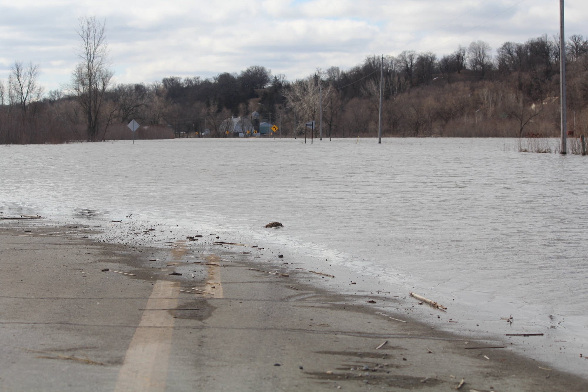
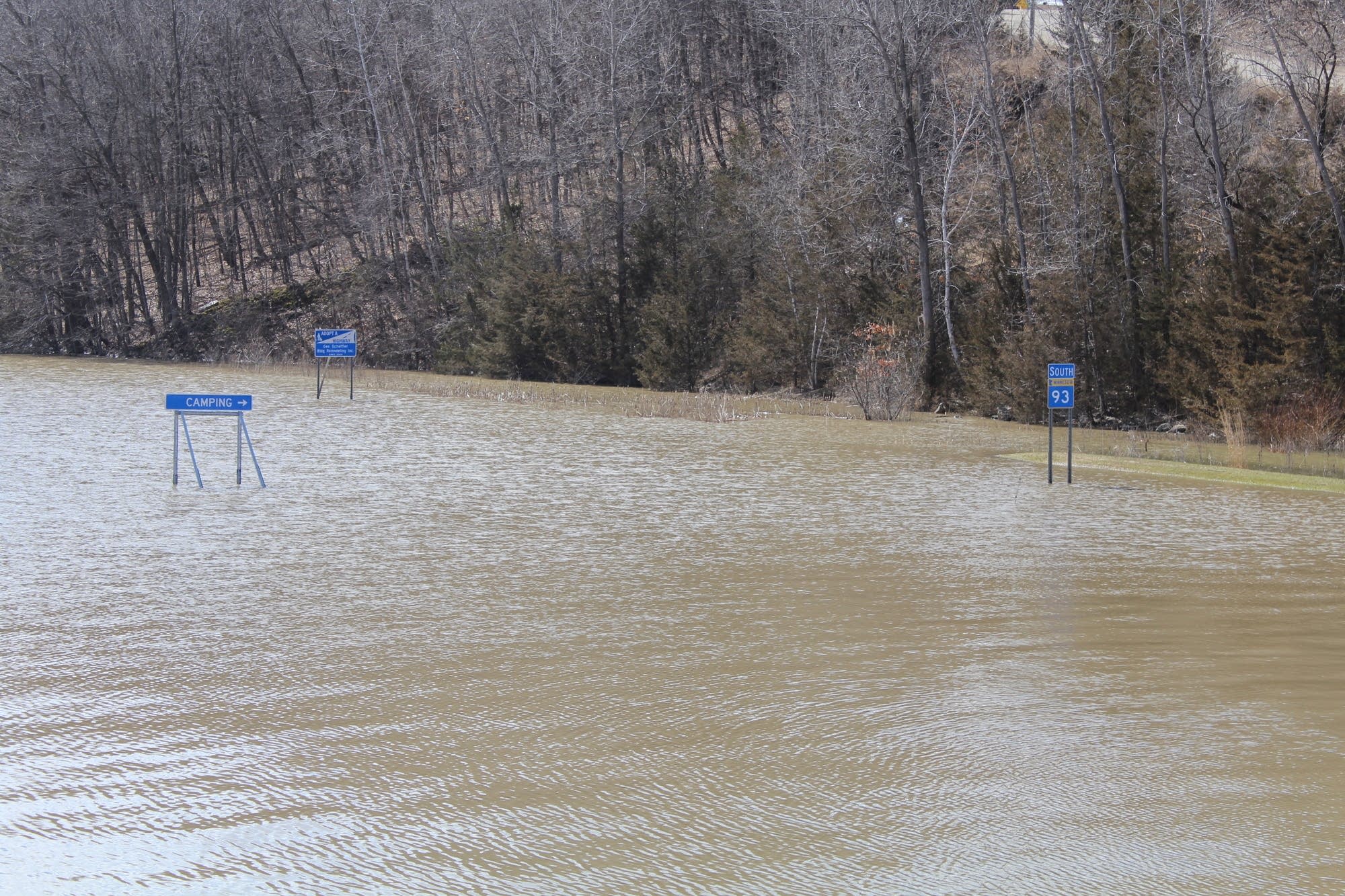
Montevideo and Granite Falls: Minnesota River begins gradual decline this week
Progress is being measured by inches in Montevideo and Granite Falls, where the Minnesota River remains at flood stage but is on a gradual decline.
In Montevideo, the river has declined from a crest of 21.29 feet on Saturday to 19.4 feet on Wednesday. It's projected to fall to the 18-foot level early next week, after which sewer service could be restored to areas that have been shut down since last week.
In Granite Falls, the river has declined from a crest of 893.52 feet on Saturday to 891 feet, and it is projected to continue a slow but steady decline in the days ahead as well.
The swollen river remains well above its banks in Montevideo, and its waters continued to flow across U.S. Highway 212 at the bridge south of town.
Still, the downward trend is allowing things to return closer to normalcy. It gave Randy Leppke and his staff at Heather Floral and Nursery in Montevideo's Smith Addition the confidence they needed to begin returning plants and items to the business and its two greenhouses.
They had cleared out two greenhouses full of new plantings on March 26 in anticipation of rising waters.
Leppke said they brought the first plants back to the greenhouses Monday. They were planning to continue to return more in the upcoming days. He knows that in just a couple of weeks time, these plants will be going back out the door in the hands of customers.
The greenhouse stayed dry when the river crested, and experienced no damage.
It's pretty much business as usual throughout the Smith Addition. While the sewer remains shut off, electric and gas service is on.
Officials in both communities continue to monitor the river as well as weather forecasts. With the river projected to remain swollen for many days to come, any significant rain events could pose new problems.
— Tom Cherveny, West Central Tribune | Montevideo, Minn.
Elsewhere: Flooding season brings back memories

As the anxiety and preparations of flooding season shift northward with the melt, the memory of historic floods of the past have come back to many communities:
Winona: The Winona Daily News has republished its Flood of '65 retrospective, in several parts.
The floodwaters of April 1965 began falling on rain-sodden cornfields as farmers struggled with a muddy harvest the previous fall. During September, significantly-above-average autumn rainfall fell throughout the Mississippi River watershed, soaking the soil throughout the region. The National Weather Service recorded measurable precipitation 16 of September's 30 days, with the Mason City, Iowa, reporting station measuring nearly 5 inches more rain than normal for the month. The saturated soil held its moisture through October and into November, when a sharp and persistent drop in temperatures drove the frost into the wet earth deep and hard.
Stillwater: Resident and hobby photographer Howard Peulen took his camera to the aptly-coined "Teenager's Dike" in the spring of 1965 as his son Bob, now 77, filled sandbags.
"He took pictures all over the St. Croix, that was his passion," Bob Peulen recalled.
The Peulen family shared Howard's photos this week, as the St. Croix River at Stillwater, which forms Minnesota's border with Wisconsin, has crested and begun to recede after hitting a major flood stage that caused only minor damage.
Montevideo: A veteran of the 1997 flooding and her crew at the Cenex Travel Plaza in Montevideo pitched in to feed the volunteers and firefighters working to build up the city's levees this week.