Midwest sees spring transform into winter weather
By HEATHER HOLLINGSWORTH, Associated Press
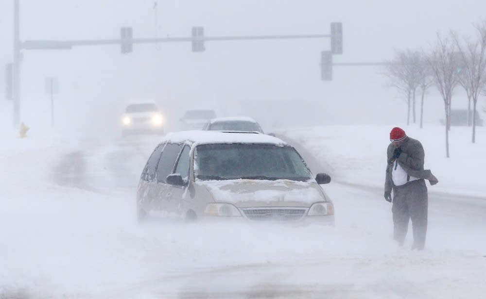
KANSAS CITY, Mo. (AP) -- Few signs of spring are being found in parts of the Midwest as a snowstorm tracks mostly along Interstate 70, bringing heavy snow and high winds.
The National Weather Service said parts of Colorado and northwest Kansas saw 10 to 15 inches of snow Saturday, and southwestern Nebraska had up to 7 inches. Winds gusting at speeds of up to 45 mph created snow drifts of 2 to 3 feet in the three states, said Ryan Husted, a meteorologist with the National Weather Service in Goodland, Kan.
"We have pretty much cleared out. Sunny skies. It's starting to melt a little bit," Husted said Sunday.
Create a More Connected Minnesota
MPR News is your trusted resource for the news you need. With your support, MPR News brings accessible, courageous journalism and authentic conversation to everyone - free of paywalls and barriers. Your gift makes a difference.
Points eastward weren't as lucky as the system moved on. Winter storm warnings and advisories have been issued for Sunday and Monday as far east as Pennsylvania.
The storm dumped 7 to 9 inches of snow from eastern Kansas into central Missouri before tapering off Sunday morning, Dan Hawblitzel, a meteorologist with the National Weather Service in suburban Kansas City, said. In the mid-Missouri town of Columbia, TV station KOMU was briefly evacuated Sunday morning because of high winds and a heavy buildup of snow on the broadcast tower next to the building.
But there was no cause for college basketball fans in Kansas City to be concerned, as the snow didn't affect the NCAA men's tournament schedule.
"The snow is not an issue," said Wynn Butler, 62, of Manhattan, Kan., who was in town with his daughter, a University of Kansas graduate, to watch her alma mater take on North Carolina.
He said his car is in a parking garage, and he can walk from his hotel to the Sprint Center. Butler also figures the roads will be clear before they leave after the game, which was scheduled to start late Sunday afternoon.
"We are right in between the bad weather," he said.
Snow began to fall in earnest in St. Louis and western Illinois on Sunday morning.
"The snow intensity is pretty heavy, so the visibility is low," said Todd Waelterman, director of the City of St. Louis Streets Department. "So we've asked people to stay off the road and let our plows do their job. And people seem to be heeding that warning."
St. Louis could see between 8 to 10 inches of snow, Hawblitzel said, while western and central Illinois could get 6 to 9 inches. The storm also was brushing northern Oklahoma and Arkansas.
Forecasters predict that the storm will arrive in Indiana late Sunday afternoon and into night, dumping 6 to 10 inches of snow. The system then will move into Ohio on Sunday night, bringing between 5 to 9 inches, Hawblitzel said.
The storm is expected to weaken as it moves into Pennsylvania late Sunday and into Monday, with totals ranging from 3 to 8 inches. Before it exits off the coast of New Jersey on Monday night, the storm could leave 1 to 3 inches in southern New York and New Jersey.
"It's definitely a wide-hitting system," Hawblitzel said.
---
Associated Press reporters Thomas Peipert in Denver and Sandy Kozel in Washington contributed to this report.
