Photos: A national park in the heart of the Cities

The Lake Street bridge from Shadow Falls Park
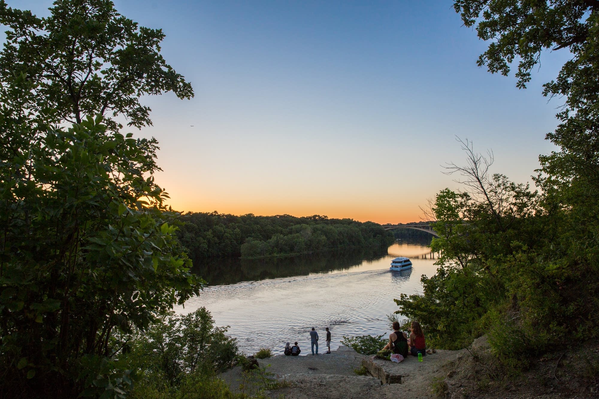
The Lake Street bridge stretches across the Mississippi as couples and friends enjoy the sunset atop the bluff near the World War I Veterans Memorial Monument in Shadow Falls Park Preserve, which sits at the western end of Summit Avenue in St. Paul.
Evan Frost | MPR News

The winding path of a river through an urban landscape doesn't often give off "national park' vibes — with no grand vistas, towering mountains or hostile wilderness.

But in the Twin Cities, the closest national park is just that: The Mississippi National River and Recreation Area is a 72-mile stretch of the Mississippi from the riverbanks at Dayton through the drop at St. Anthony falls to the flats south of Hastings.

As the river flows downstream, the northern cities of Dayton, Anoka and Fridley give way to the industrial neighborhoods — and then towering downtown — of Minneapolis. Here it changes from the easy-flowing prairie river into the tumbling rushing waters of the limestone St. Anthony gorge.

As an urban park, the Mississippi National River offers year-round access by land or water — or bike or canoe or riverboat or foot — along, above and beside the river, each approach offering a perspective much different than what casual passersby might catch.

On the centennial of the National Park Service, we offer a glimpse of Minnesota's six national parks sites. First: Our most urban and most populated — and most easily overlooked.

Think we missed something? Do you have a memory or a bit of history to share? Tell us your national park story, from the Mississippi or beyond.

Political Coverage Powered by You

Your gift today creates a more connected Minnesota. MPR News is your trusted resource for election coverage, reporting and breaking news. With your support, MPR News brings accessible, courageous journalism and authentic conversation to everyone - free of paywalls and barriers. Your gift makes a difference.