I-35W shutdown tops Twin Cities weekend driving woes
Go Deeper.
Create an account or log in to save stories.
Like this?
Thanks for liking this story! We have added it to a list of your favorite stories.


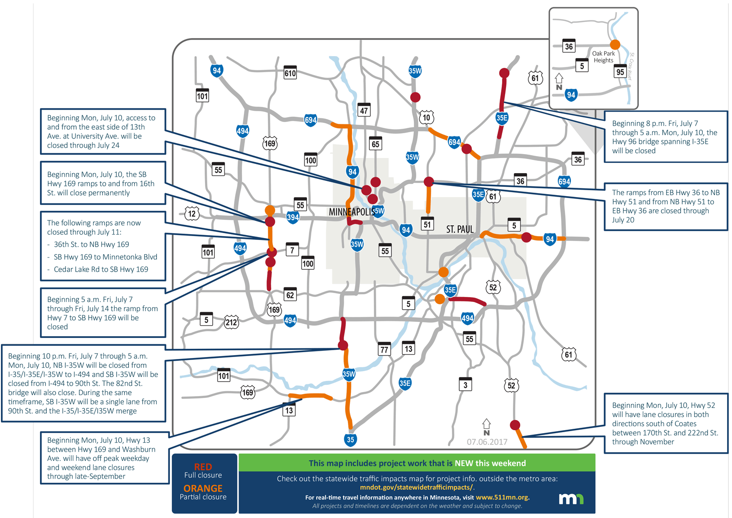
We warned you earlier this week about this weekend's Interstate 35W closure between Burnsville and Bloomington. Now, it's just hours away.
But it won't be the only road and ramp closures in your way this weekend. The Minnesota Department of Transportation has all the details updated on its website. Here are the highlights.
I-35W, Bloomington and Burnsville
Turn Up Your Support
MPR News helps you turn down the noise and build shared understanding. Turn up your support for this public resource and keep trusted journalism accessible to all.
Crews will start closing the I-35W ramps at 8 p.m. Friday to prepare for the hard closure at 10 p.m.
• Northbound I-35W will close between the Interstate 35 split in Burnsville and Interstate 494 beginning at 10 p.m.
• Southbound I-35W will fully close at the same time between I-494 and 90th Street and remain a single lane southbound between 90th Street and I-35
While the highway is closed, MnDOT plans to pave northbound I-35W at McAndrews Road in Burnsville, remove the 86th Street bridge over I-35W in Bloomington and remove part of the 82nd Street bridge deck over I-35W in Bloomington. All lanes are scheduled to reopen by 5 a.m. Monday.
U.S. Highway 169, Edina to Golden Valley
Beginning 5 a.m. Friday through July 14, the ramp from Minnesota Highway 7 to southbound Highway 169 will be closed. Beginning Monday, the southbound Highway 169 ramps to and from 16th Street will close permanently.
The following ramps are now closed through July 11:
• 36th Street to northbound Highway 169
• Southbound Highway 169 to Minnetonka Boulevard
• Cedar Lake Road to southbound Highway 169
Interstate 35E, Vadnais Heights, White Bear Lake
Beginning 8 p.m. Friday through 5 a.m. Monday, the Minnesota Highway 96 bridge spanning I-35E will be closed.
Heading somewhere in greater Minnesota this weekend? MnDOT has a map for that.