Southern Minn. rivers likely to rise again from spring snowstorm melt; Red River Valley remains hopeful

Spring flooding in Red Wing, 2019
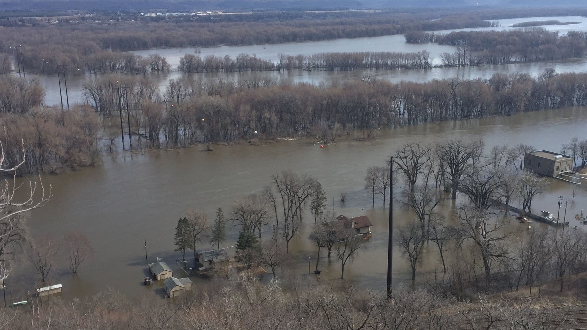
A few island and riverfront properties are inundated by waters of the Mississippi River on April 2 in Red Wing, Minn.
Andrew Krueger | MPR News

Updated: 4:30 p.m. | Posted: 6:47 a.m.

Just as celebrations of "ideal conditions" and the "perfect melt" began creeping into talk of the spring flood season in Minnesota, the reminder that spring can be unpredictable has arrived: Several forecasts suggest the state might be in for a walloping winter storm by the end of the week

And while forecasters are loath to commit to detailed predictions just yet, the National Weather Service said Sunday that "confidence is increasing for the potential of significant snow" on the cold side of a very strong low-pressure system likely barreling toward us from the west.

Create a More Connected Minnesota

MPR News is your trusted resource for the news you need. With your support, MPR News brings accessible, courageous journalism and authentic conversation to everyone - free of paywalls and barriers. Your gift makes a difference.

The NWS said higher temperatures and rain will continue to trigger widespread overland flooding and potential ice jams on streams and rivers in the Red River Valley early this week.

In the meantime, Minnesotans across the state will continue to watch and wait with one eye on the latest forecast and one on the nearest river gauge.

Across the state: Minnesota rivers to rise again from spring snowstorm melt

Forecasters say a spring snowstorm barreling toward Minnesota this week contains enough moisture to cause rivers to rise again.

The National Weather Service in Chanhassen says the storm could dump 8 inches or more of heavy, wet snow in western Minnesota while Minneapolis-St. Paul could see 4 to 8 inches.

Weather Service Hydrologist Craig Schmidt says rivers in Minnesota will likely "turn around and start rising again." Schmidt says if the precipitation falls mainly as rain, rivers would "respond quickly and come up higher."

The forecast calls for below-normal temperatures following the storm, which Schmidt says would make for a slower snowmelt. He says rivers could start rising by the end of this week, and some rivers could reach moderate to major flood stage.

The storm has flood fighters in the Red River Valley concerned, but the National Weather Service says the storm should not affect river flooding in northwestern Minnesota.

Forecaster Greg Gust said the southern reaches of the Red River could see up to a half-inch of moisture on Wednesday and Thursday.

That moisture, he said, "is going to be coming in behind this flood crest, so it's going to be days before that moisture gets into the river system up here."

The Red River in Fargo-Moorhead is expected to reach its highest level sometime Monday — and will start falling.

The flooding has had minimal impact in Fargo and Moorhead, but dozens of homes in rural areas are now feeling the effects of the floodwaters.

In Cass County, N.D., county commission chair Mary Scherling says crews and National Guard soldiers have been making emergency sandbag deliveries to rural homes as the water rises.

"The problem is [that] some of these places have never flooded before, and all of a sudden there's water lapping up at your back door, coming across the field, so we've been very, very busy," she said.

Water levels in rural areas should start to fall later this week. National Weather Service forecasters say a spring storm expected this week will not affect peak flood levels.

— The Associated Press and Dan Gunderson | Moorhead, Minn.

Northwest Minnesota: More road closures, anticipation and overland flooding

A contingent of University of Minnesota Crookston students place sandbags.
A contingent of the University of Minnesota Crookston students and staff place sandbags along Riverside Avenue Wednesday. In the foreground, Matt Peterson and Shuyu Wang add to the sandbag wall.
Jess Bengtson | Crookston Times

As the Red River continues to rise along the Minnesota-North Dakota border, flooding is forcing more road closures in northwestern Minnesota and northeastern North Dakota.

The latest addition: The Sorlie Bridge linking downtown Grand Forks, N.D., and East Grand Forks, Minn., will close at noon Monday. The closure is happening now so crews can install floodwalls across Demers Avenue, the road that connects the two cities.

The level of the Red River at East Grand Forks was at about 38.8 feet as of 7 p.m. Sunday; about 10 feet above flood stage. The river is forecast to rise about another 10 feet by the end of the week, still well under its 1997 record of 54.35 feet.

Meanwhile, overland flooding from melting snow also was causing high water along some highways on Sunday. The Minnesota Department of Transportation's District 2, in the northwestern part of the state, reported water over the road along Highway 9 between Ada and Crookston.

The highway remained open to traffic, but MnDOT advised drivers to slow down.

Flooding also was reported along State Highway 220 north of Oslo, Minn., and water was reported along the edge of the roadway on Interstate 29 near Hillsboro, N.D., between Fargo, N.D., and Grand Forks.

Cass County, N.D., engineer Jason Benson told The Associated Press that Gardner, about 20 miles north of Fargo, is "getting hit a little bit harder" than other areas with overland flooding that is filling fields and overtopping townships roads. He says officials have responded to three calls for emergency sandbagging of residences in the area.

— MPR News Staff & The Associated Press

Southwest Minnesota: Damages surface as waters recede

In southwestern Minnesota, as floodwaters continue their slow descent along the Minnesota, Redwood and Cottonwood rivers, damages from the waters are beginning to surface.

The Worthington Daily Globe reports that the material used to maintain the structure of a spillway off Lake Okabena was damaged — for the second time since it was installed — during spring flooding this year. The spillway was built as part of the water quality project at the former Prairie View Golf Links property and is managed by the Okabena-Ocheda Watershed District.

And southeast of Granite Falls, the West Central Tribune reports, a stretch of Highway 67 near Upper Sioux Agency State Park has been closed because the surface of the road collapsed after the flooding.