Military flights sent to assess damage from Pacific volcano
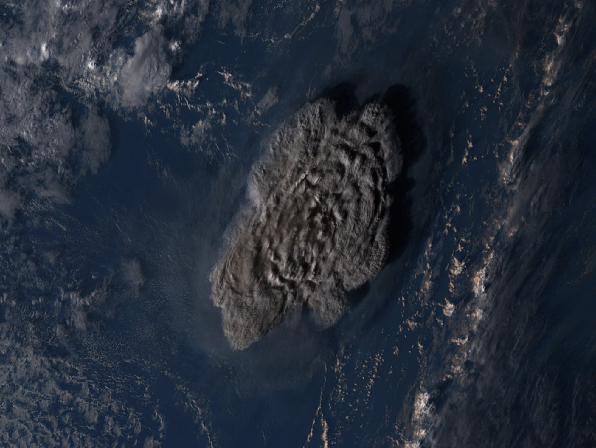
This satellite image taken by Himawari-8, a Japanese weather satellite operated by Japan Meteorological Agency and released by National Institute of Information and Communications Technology, shows an undersea volcanic eruption near the Pacific nation of Tonga on Saturday.
NICT via AP
Go Deeper.
Create an account or log in to save stories.
Like this?
Thanks for liking this story! We have added it to a list of your favorite stories.
