
Temperatures and humidity rise a bit; thunder chances far north on Thursday
Go Deeper.
Create an account or log in to save stories.
Like this?
Thanks for liking this story! We have added it to a list of your favorite stories.


As I was coming out of a store on Wednesday, I was flashed a “thumbs up” sign followed by a “keep this weather coming!” comment by a someone who recognized me. I haven’t heard any complaints about this three-day stretch of comfortable temperatures and low humidity levels.
If you like it a bit warmer, you’ll like this weekend.
Temperature trends
Thursday highs will reach the 80s across most of Minnesota and western Wisconsin:
Turn Up Your Support
MPR News helps you turn down the noise and build shared understanding. Turn up your support for this public resource and keep trusted journalism accessible to all.
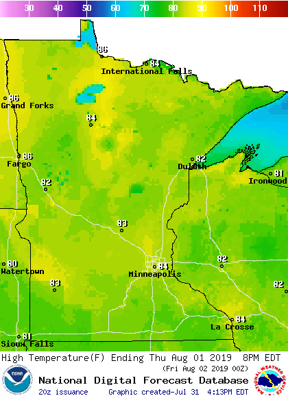
Similar highs are on tap for Friday.
Dew points will return to the 60s in many locations Thursday afternoon, and they’ll stay in the 60s into the weekend. It won’t be really steamy, but it’ll feel summery.
Highs in the 80s will be common this weekend, too, with a few 70s in northeastern Minnesota. Here are the forecast highs on Saturday:
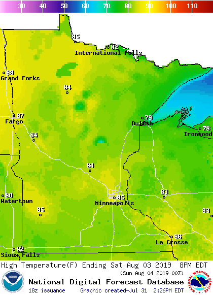
The Twin Cities metro area highs are projected to reach the mid-80s on Friday and this weekend. That streak continues on Monday, followed by lower 80s next Tuesday and Wednesday.
Rain and thunder chances
Far northern Minnesota will have a chance of scattered showers and thunderstorms Thursday afternoon. The National Weather Service Storm Prediction Center shows a marginal risk of severe weather Thursday and Thursday night in northwestern and north-central Minnesota.
Here are details of the severe weather risk, from the Grand Forks, N.D., office of the National Weather Service:

The Storm Prediction Center will update the severe weather outlook on Thursday.
As always, updated weather information can be heard on the Minnesota Public Radio Network, and you’ll also see updated weather info on the MPR News live weather blog.
Hurricane Erick
Hurricane Erick is expected to track south of Hawaii over the next few days:
Here’s the projected path of the center of Erick, from the NWS Central Pacific Hurricane Center:
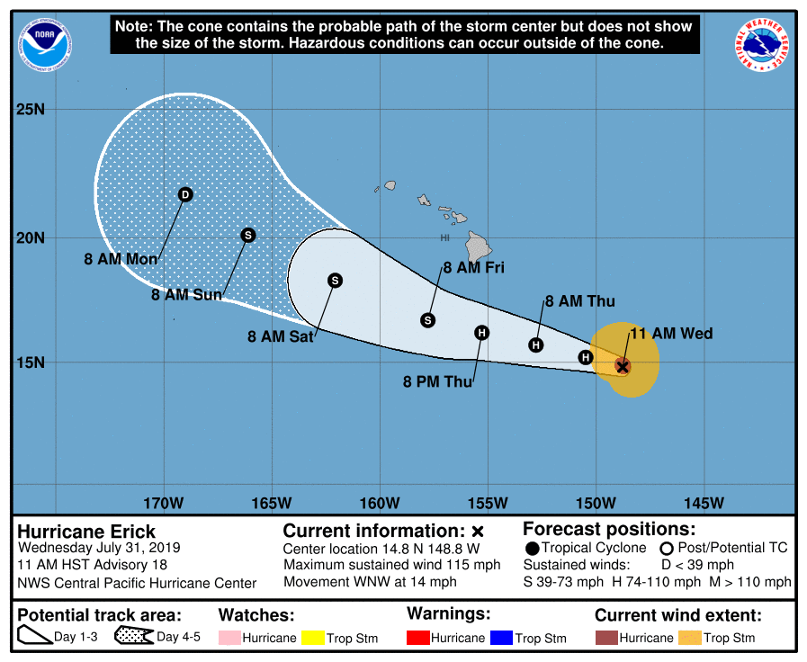
The Big Island of Hawaii could see heavy rains from Erick, details at the NWS Honolulu site.
Programming note
You can hear my live weather updates on Minnesota Public Radio at 7:49 a.m. Thursdays and Fridays, and at 7:35 a.m., 9:35 a.m. and 4:35 p.m. each Saturday and Sunday.

