
Some very large hail reports from Monday; looking forward to a quiet Tuesday
Go Deeper.
Create an account or log in to save stories.
Like this?
Thanks for liking this story! We have added it to a list of your favorite stories.


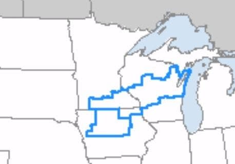
The Twin Cities metro area saw two rounds of thunderstorms on Monday. The severe thunderstorm watch was cancelled for the entire metro area by 6 p.m. Monday, but it continued until 10 p.m. Monday for portions of southern Minnesota and parts of Wisconsin:
Large hail
Look at this 4-inch diameter — softball-size — hail that fell early Monday afternoon near Delano, Minn:
This spot in Watertown, in Carver County, had tennis-ball size hail:
Turn Up Your Support
MPR News helps you turn down the noise and build shared understanding. Turn up your support for this public resource and keep trusted journalism accessible to all.
You can check here for additional severe weather reports. Hover over any report on their map for details about the severe weather.
As always, updated weather information can be heard on the Minnesota Public Radio Network, and you’ll also see updated weather info on the MPR News live weather blog.
You can see the recent local National Weather Service radar loop here. The recent radar loop for southwestern Minnesota can be found here, and the southeastern Minnesota loop here.
A quiet Tuesday
Thankfully, Tuesday will be a dry day across most of Minnesota and western Wisconsin.
Tuesday highs reach the low to mid-80s:
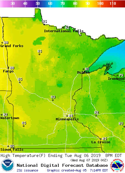
The Twin Cities metro area highs are projected to reach the lower 80s Wednesday, then around 80 on Thursday and Friday.
Wednesday rain chances
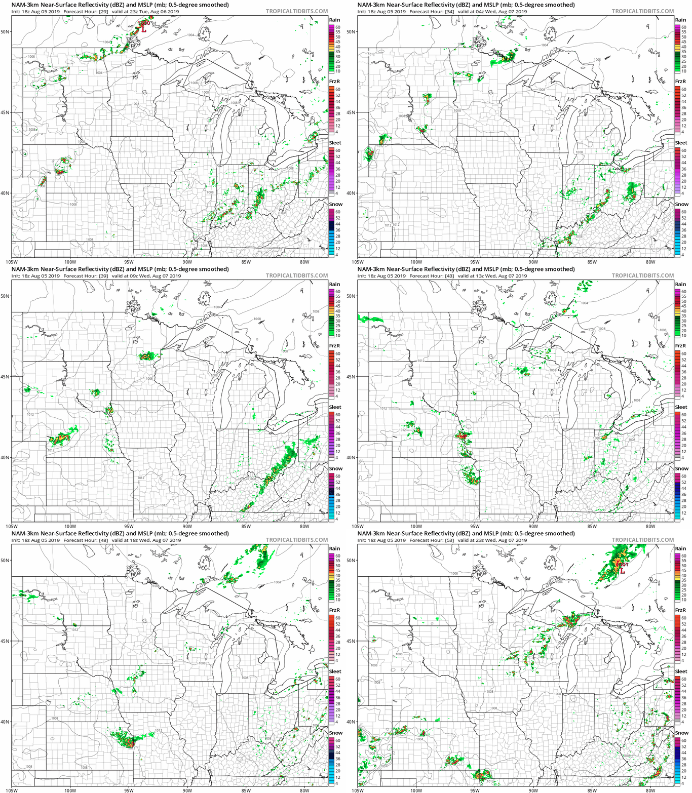
Scattered showers and thunderstorms could move into northwestern Minnesota Tuesday night and spread southeastward on Wednesday.
The National Oceanic and Atmospheric Administration's North American Mesoscale forecast model shows the potential rain pattern Tuesday night through Wednesday afternoon:
Check forecast updates.

