
Snow update for Tuesday PM into Wednesday; December to start out cool
Another batch of snow on Saturday?
Go Deeper.
Create an account or log in to save stories.
Like this?
Thanks for liking this story! We have added it to a list of your favorite stories.


Our highs will be above average today and Monday. Of course, when we mention above-average high temps in late November, we aren’t saying that you won’t need your jacket or coat.
Temperature trends
Sunday highs will be mostly in the 40s across Minnesota and western Wisconsin, with some 30s in far northern Minnesota. A few spots in southwestern Minnesota could reach the lower 50s.
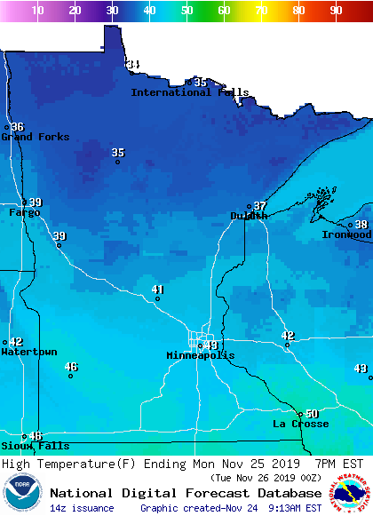
Monday high will reach the 40s south with 30s north:
Turn Up Your Support
MPR News helps you turn down the noise and build shared understanding. Turn up your support for this public resource and keep trusted journalism accessible to all.
Most spots will have highs in the 30s on Tuesday:
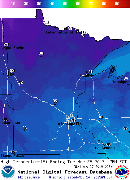
Twin Cities metro area highs are projected to be in the middle 30s Wednesday and Friday, with lower 30s on Thanksgiving.
Sunday into Monday precip
A few light rain showers or sprinkles will be possible Sunday in about the southern half of Minnesota, plus the northwest. The Twin Cities metro area and western Wisconsin could see a passing afternoon sprinkle. Listen for updated weather information on the MPR network, and you’ll also see updated weather info on the MPR News live weather blog.
Rain showers and snow showers expand across far northern Minnesota overnight, and periods of snow or a wintry mix are expected in the far north on Monday:
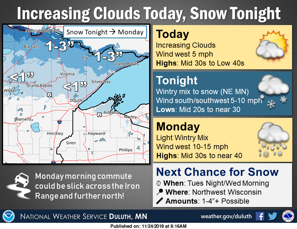
Check updates if you are traveling in northern Minnesota Sunday night or Monday.
Tuesday/early Wednesday snow update
Forecast models continue to show snow spreading across southern and east-central Minnesota and western Wisconsin from Tuesday afternoon into Tuesday evening, with the snow continuing overnight Tuesday night and ending Wednesday morning.
The National Oceanic and Atmospheric Administration's Global Forecast System (GFS) model shows this potential precipitation pattern Tuesday through Wednesday:
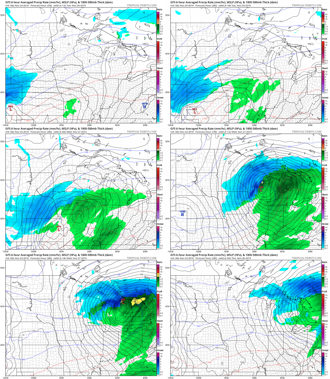
The storm track could still change as we get closer to Tuesday, but be prepared for potential travel impacts Tuesday PM and early Wednesday.
Your odds of accumulating snow are highest to the south and east, as illustrated by this NWS graphic:
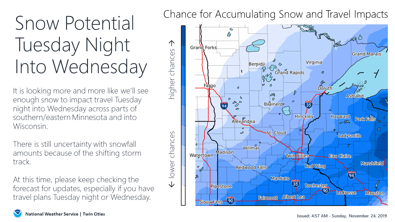
It’s too early to give detailed snow amounts, but it does look like the Twin Cities will probably see enough to shovel, with heavier snow amounts to our south and east.
Some forecast models are showing a strong low pressure system spreading snow or a rain/snow mix over Minnesota and western Wisconsin late Friday into Saturday. We’ll have more on that in the coming days.
Cool start to December?
December is just one week away!
The eight-to-fourteen day (Dec.1 through Dec. 7) temperature outlook from the National Weather Service Climate Prediction Center shows a strong probability of cooler than normal temps for Minnesota and much of Wisconsin:
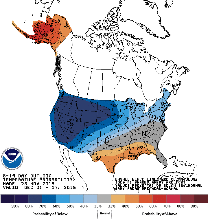
You can have a mild day at some point in that week and still end up with an average temp for the 7-day period that’s below normal.
Programming note
You can hear my live weather updates on Minnesota Public Radio at 7:35 a.m., 9:35 a.m. and 4:35 p.m. each Saturday and Sunday.

