
Snow slows our Monday morning commute; arctic chill after the snow
Highest snow amounts to the north
Go Deeper.
Create an account or log in to save stories.
Like this?
Thanks for liking this story! We have added it to a list of your favorite stories.


I know, the timing of this snow could be better.
Snow is expected to spread across most of Minnesota and western Wisconsin from Sunday evening through the overnight hours of Sunday night, then linger into Monday. Some patchy freezing drizzle is also possible. It’ll snow through much of Monday morning in eastern Minnesota and western Wisconsin, then taper off from west to east Monday afternoon.
The National Oceanic and Atmospheric Administration's North American Mesoscale (NAM) forecast model shows the potential precipitation pattern from Sunday evening through Monday afternoon:

Western Minnesota will see most of their accumulating snow during the overnight hours of Sunday night, while eastern Minnesota and western Wisconsin see more morning snow.
Turn Up Your Support
MPR News helps you turn down the noise and build shared understanding. Turn up your support for this public resource and keep trusted journalism accessible to all.
Here’s the NWS snow scenario for the Twin Cities metro area and central Minnesota, with “tonight” referring to Sunday night and “this evening” referring to Sunday evening:
The timing of the snow is expected to slow down morning commutes in many locations, including the Twin Cities metro area:
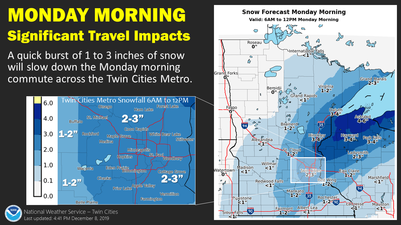
The snow amounts in the forecast graphic are for the 6 a.m. to noon time period on Monday. Parts of western Minnesota will see several inches of accumulating snow overnight Sunday night that aren’t included in the graphic. By early Monday afternoon, metro area snow totals could range from about 2 inches in the far south metro to around 3 inches in the central metro (including Minneapolis and St. Paul) to almost 4 inches in parts of the far north metro.
Allow extra time for your Monday morning commute. You can also check Minnesota road conditions and Wisconsin road conditions before you head out the door.
You’ll hear updated weather information on the MPR network, and you’ll see updated weather info on the MPR News live weather blog.
Warnings and advisories
A winter weather advisory starts at 3 a.m. Monday in the Twin Cities metro area and continues until noon on Monday.
Winter storm warnings and advisories start earlier to the north and west. Here are the updated winter storm warnings and winter weather advisories from Sunday evening into Monday, with various start times:

The dense fog advisory in southwestern and south-central Minnesota continues through 3 a.m. Monday.
You can check for forecast details and updated advisories and warnings from the Duluth, Twin Cities and Grand Forks offices of the NWS.
Some of the highest snow totals are expected to the north and northeast. “Tonight” refers to the overnight hours of Sunday night:

Here are the winter storm warning areas and winter weather advisories to the north and east:

And to the northwest:

Arctic chill moves in after the snow
Our second weather headline is the blast of arctic air that spreads across Minnesota and Wisconsin after the snow. Monday highs will happen before sunrise in many locations, with falling temps during the day.
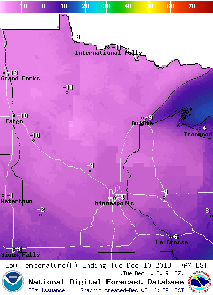
Low temps late Monday night/early Tuesday are below zero:
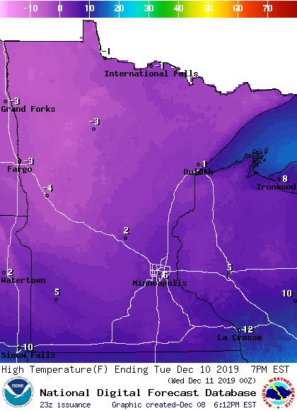
Tuesday highs are in the single digits below zero in the north, and slightly above zero in the south:
Our coldest low temps occur Wednesday morning:
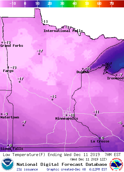
Some spots in northern and central Minnesota will probably dip into the 20s below zero early Wednesday morning. The record Dec. 11 low temp in the Twin Cities is -14, set in 1972. We could be close to that temp!
Our Twin Cities high temp is expected to be in the single digits above zero on Wednesday, followed by lower 20s Thursday and around 30 on Friday. That temperature rebound late in the week will feel great!

