
Mild Saturday temps, shower and t-storm chances in some areas
Morning fog burns off
Go Deeper.
Create an account or log in to save stories.
Like this?
Thanks for liking this story! We have added it to a list of your favorite stories.


Parts of west-central and central Minnesota have fog this Saturday morning, but that should burn off in a few hours.
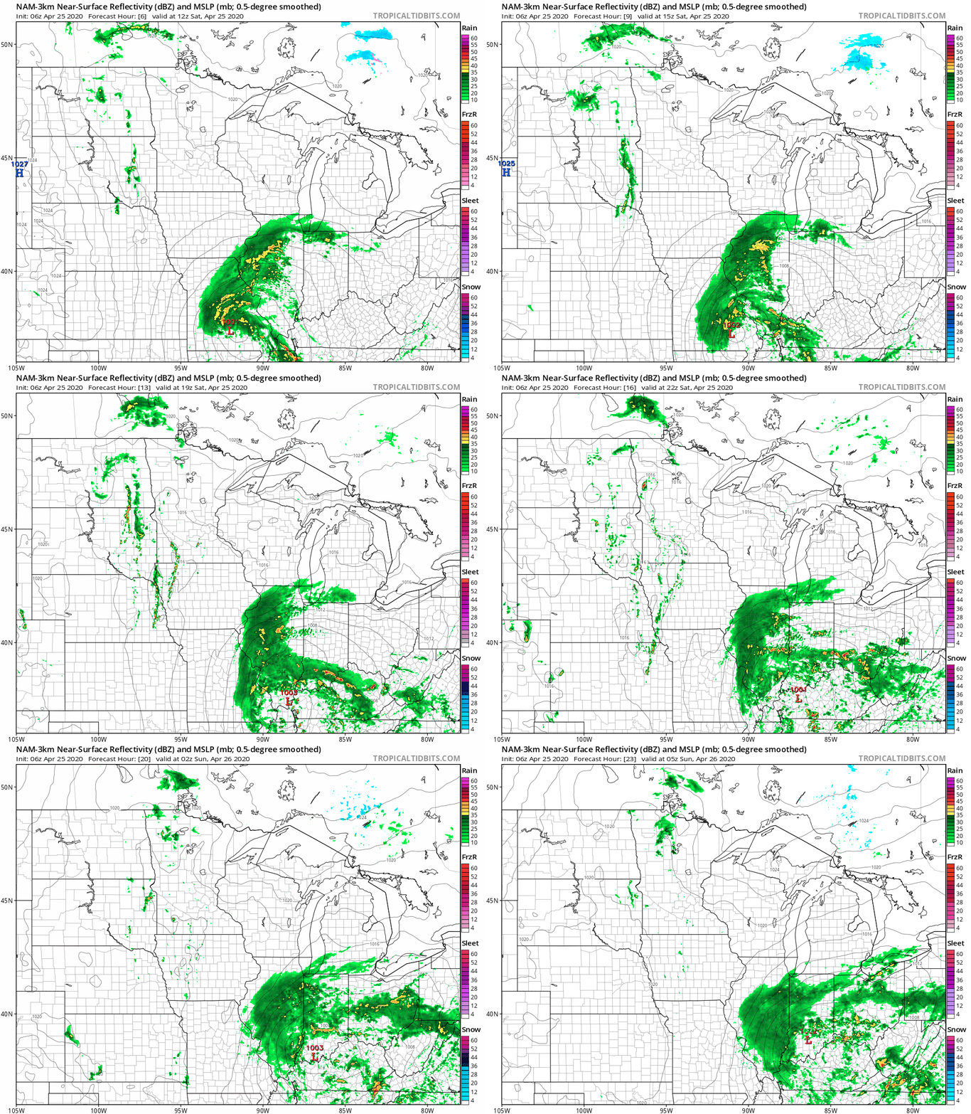
The chance of showers and thunderstorms is highest in western Minnesota and far southern Minnesota for much of Saturday, but eastern Minnesota and western Wisconsin may see some scattered showers and an isolated t-storm anytime from about mid-afternoon into this evening.
The National Oceanic and Atmospheric Administration’s North American Mesoscale (NAM) forecast model shows the potential precipitation pattern Saturday and Saturday evening:
You can hear updated weather information on the MPR network, and you’ll see updated weather info on the MPR News live weather blog.
Turn Up Your Support
MPR News helps you turn down the noise and build shared understanding. Turn up your support for this public resource and keep trusted journalism accessible to all.
Mild temps
Saturday afternoon highs will be mainly in the 60s across Minnesota and western Wisconsin. Some 50s are expected in northeastern Minnesota:
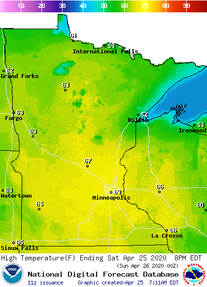
A few spots up along the North Shore of Lake Superior might only reach the upper 40s.
Winds will be light in most locations this Saturday, but gusty winds are expected in parts of northeastern Minnesota and far northwestern Wisconsin:
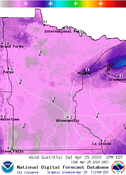
Winds will also be gusty near any thunderstorms that develop.
An updated Updraft blog with details on our Sunday weather and the week ahead will be posted around 10 a.m. today.
Programming note
You can hear my live weather updates on MPR News at 7:35 a.m., 9:35 a.m. and 4:35 p.m. each Saturday and Sunday.

