
Two satellites are better than one
Go Deeper.
Create an account or log in to save stories.
Like this?
Thanks for liking this story! We have added it to a list of your favorite stories.


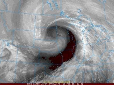
While it might feel more like a fall day, this image is just an example of the water vapor image for a NOAA eye in the sky called GOES. This geostationary satellite is invaluable to monitoring developing weather, especially critical for tropical storm formation.
On Saturday NOAA and NASA successfully launched GOES O. This satellite will be prepared to take over if one of the other GOES fails. Since these satellite travels in sequence with the earths rotation we can animate the imagery.
One GOES monitors the Pacific region and one the Atlantic. There was a time when I worked for NOAA that we did not have a spare ready in place and were required to reposition the east monitoring GOES towards the central part of the northern hemisphere to get a view of the Pacific during hurricance season.
Turn Up Your Support
MPR News helps you turn down the noise and build shared understanding. Turn up your support for this public resource and keep trusted journalism accessible to all.
NASA press release on the latest GOES launch
Always nice to have a spare.
I want my summer back.
CE

