
A little fluff
Go Deeper.
Create an account or log in to save stories.
Like this?
Thanks for liking this story! We have added it to a list of your favorite stories.


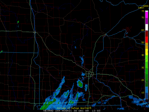
High reolution radar from the College of Dupage, centered on Minnesota at daybreak.
Click on radar icon on the weather page for the latest radar image.
Overnight light snow developed in southwest Minnesota and Iowa. A push of milder air is exciting the clouds to drop some light, low water content snow. While flurries are possible statewide today, the best chance for an inch or two of accumulation will be from the Minnesota River Valley to Preston.
Turn Up Your Support
MPR News helps you turn down the noise and build shared understanding. Turn up your support for this public resource and keep trusted journalism accessible to all.
Last week we spoke of water to snow ratio of being on the order of one inch of moisture to ten inches of snow. Eventually, on Christmas day that changed to about a one inch of moisture to four inches of snow. Today, we will see snow ratios of about twenty to one.
With the temperatures staying only in the lower 20s there may be some greasy spots on the roadways. Be careful. A small coating of snow can make the roads surprisingly slick.
For hardy Minnesotans, I'd like to know what you consider as BITTER COLD? I'm not originally from around here, so I'm thinking when the high temperature fails to reach zero during the daylight hours.
CE

