
Looking for the trigger
Go Deeper.
Create an account or log in to save stories.
Like this?
Thanks for liking this story! We have added it to a list of your favorite stories.


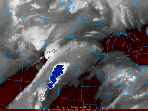
Water vapor satellite image from 645pm CDT. The brighter the colors, including the blue mean colder/higher cloud tops.
After heating up to the first ninety degree day in the Twin Cities since May 29th we have plenty of fuel for Mother Nature to ingnite tonight.
Examining the late afternoon water vapor satellite image it appears that the missing piece of the severe weather puzzle is showing up in western Nebraska.
Thunderstorms are more likely to fire up after dark and spawn locally heavy rain for parts of southern Minnesota. The risk of severe weather also remains.
CE
Turn Up Your Support
MPR News helps you turn down the noise and build shared understanding. Turn up your support for this public resource and keep trusted journalism accessible to all.

