
Tracking a cold front
Go Deeper.
Create an account or log in to save stories.
Like this?
Thanks for liking this story! We have added it to a list of your favorite stories.


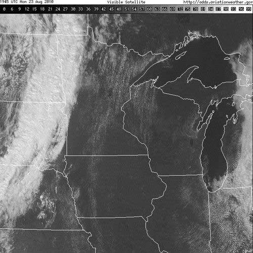
This visible satellite image paints a pretty clear picture of leading edge of a changing air mass as of mid Monday afternoon.
At 3PM CDT the temperature was 68 degrees at Aberdeen, South Dakota while it was a very warm 87 degrees at St. Cloud. Winds were gusting up to 45 miles an hour from the south ahead of the front in western Minnesota. In Aberdeen, light rain was reported with a north wind of near 10 miles an hour.
Expect this front to travel through the state in the next twelve to fifteen hours, accompanied by showers and thunderstorms. Some of the thunderstorms could be strong in central and eastern Minnesota later this afternoon and into tonight.
On Tuesday we will bask in the comfort of a refreshing air mass, that will have a autumn-like feel . Northwest winds, cooler temperatures and much lower dew points are on tap.
Shut down the air conditioning for Wednesday and Thursday, put don't think you're done with cooling system just yet. Warmer temperatures are in the offing for the weekend.
CE
Turn Up Your Support
MPR News helps you turn down the noise and build shared understanding. Turn up your support for this public resource and keep trusted journalism accessible to all.

