
Storm center slowly moving east
Go Deeper.
Create an account or log in to save stories.
Like this?
Thanks for liking this story! We have added it to a list of your favorite stories.


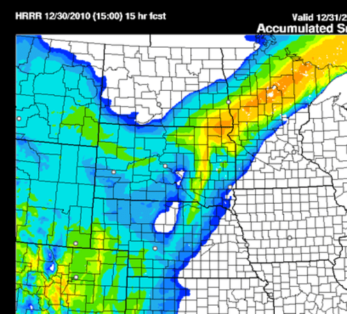
Here's an image from the High Resolution Rapid Refresh model that depicts the heaviest snow band to shift slightly south during the course of the afternoon. The red area is greater than ten inches total between 7am and 8pm today. As of 9am between five to eight inches has fallen from west of the Twin Cities through Minneapolis/St. Paul and into New Richmond Wisconsin.
Turn Up Your Support
MPR News helps you turn down the noise and build shared understanding. Turn up your support for this public resource and keep trusted journalism accessible to all.

