
First storm stills has potential
Go Deeper.
Create an account or log in to save stories.
Like this?
Thanks for liking this story! We have added it to a list of your favorite stories.


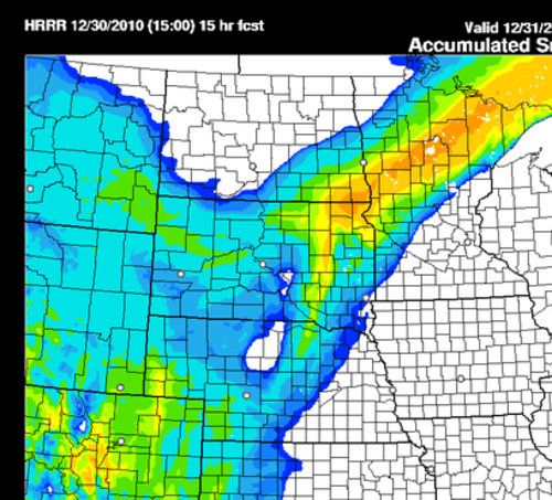
From the High Resolution Rapid Refresh model. This image depicts snowfall accumulation potential from mid morning until midnight. Greater than six inches possible in the orange shaded area.
The second storm is still on track to hammer western and north central Minnesota and eastern North Dakota on Friday and Friday night.
Regional radar snapshot at noon. Clearly plenty of moisture moving through the region in the next twelve hours.
CE
Turn Up Your Support
MPR News helps you turn down the noise and build shared understanding. Turn up your support for this public resource and keep trusted journalism accessible to all.

