
Snow abates late, but storm two soon to follow
Go Deeper.
Create an account or log in to save stories.
Like this?
Thanks for liking this story! We have added it to a list of your favorite stories.


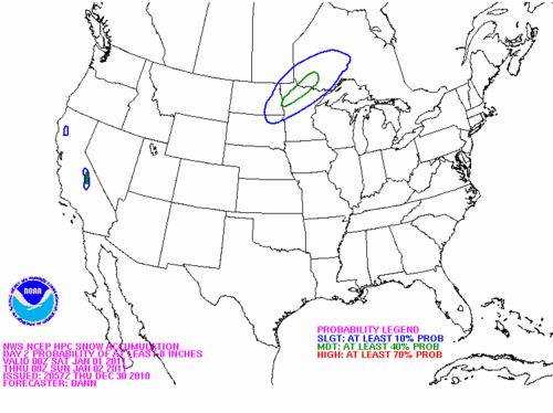
Most likely area to receive greater than eight inches of snow with the next system Friday night. Heavy snow is expected earlier in the day Friday in southwest and west central Minnesota.
While the first system continues to dump heavy snow from Moorhead to Ely tonight, the second low center will be born in Kansas during the darkness hours. The projected track of this low center and the upper air dynamics should result in another bout of heavy snow from Marshall and Fargo/Moorhead to Little Falls and International Falls.
The Twin Cities will see the cold air knife into the region tonight, but the cold rain will be cut off as well. I am looking for lull in the preciptation until Friday morning. While the models are taking the brunt of the moisture to the east of Minneapolis/St. Paul, there should be a glancing blow that could produce one to four inches of snow Friday into Friday evening for the Metro.
Turn Up Your Support
MPR News helps you turn down the noise and build shared understanding. Turn up your support for this public resource and keep trusted journalism accessible to all.
Surface weather map of pressure pattern and precipitation at 6PM CST on Friday.
Wet roadways will likely ice over as the temperatures drop tonight. Travel as conditions warrant.
Winter weather information from the Grand Forks NWS Office.
CE

