
Snow just getting started
Go Deeper.
Create an account or log in to save stories.
Like this?
Thanks for liking this story! We have added it to a list of your favorite stories.


Satellite imagery, Doppler radar and surface reports were confirming that snow was increasing in Iowa and has now crossed into southern Minnesota. Shortly after the noon hour snow was reported at Preston in southeast Minnesota.
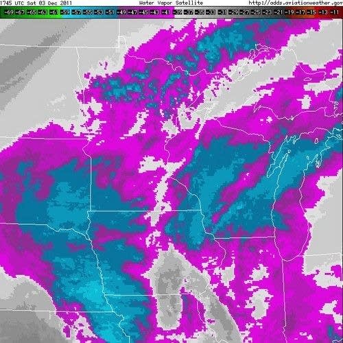
This enhanced water vapor satellite image indicated cloud tops cooling and a deeper moisture layer advancing across western Iowa. I believe this is associated with the stronger upper level dynamics that will produce heavier snow in southeast Minnesota this afternoon and into early tonight.
A Winter Weather Advisory is in effect through tonight roughly south of a line from Worthington to Hayward, Wisconsin. Expect heavier snow to accumulate from about 3PM to 10PM. By midnight snowfall totals should range from one inch in Monticello to as much as six inches in Waseca.
Turn Up Your Support
MPR News helps you turn down the noise and build shared understanding. Turn up your support for this public resource and keep trusted journalism accessible to all.
I've been sorting through the short term model data this morning. Here's a pretty good graphic from the High Resolution Rapid Refresh model displaying the expected snowfall from noon to about midnight. Note the potential for more than six inches in the yellow color.
Track the snowfall reports from the Chanhassen NWS Office from this web link.
Drive safely if you are out and about southeast Minnesota the remainder of the afternoon and tonight.
CE

