
One more comfy day coming, then the hot-and-stickies return
Go Deeper.
Create an account or log in to save stories.
Like this?
Thanks for liking this story! We have added it to a list of your favorite stories.


Monday has been the fifth consecutive day with little or no rain for most of Minnesota. There have been some showers in the north, mainly near Duluth, but amounts have been mainly less than a half-inch.
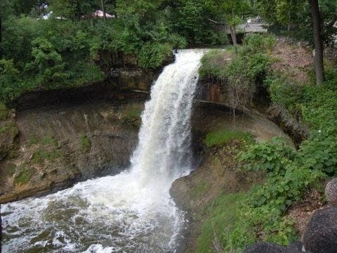
While last week's rains created so much mayhem in northeastern Minnesota centered around Duluth, there has been some beauty as well. Rivers, creeks and streams running so high l have sent some waterfalls into the "look-at-me" mode. Minnehaha Falls in south Minneapolis was putting on a lovely show over the weekend.
Tomorrow will be sunny and dry again. Expect highs from the upper 70s to the 80s. The Twin Cities should warm to about 80 degrees.
Turn Up Your Support
MPR News helps you turn down the noise and build shared understanding. Turn up your support for this public resource and keep trusted journalism accessible to all.
Hot and sticky weather will return on Wednesday with highs climbing into the 80s in northern Minnesota and 90s in the central and southern sections. Unpleasant dew points will rise well into the 60s and some low 70s.
Elsewhere, Tropical Storm Debby is a large storm moving extremely slowly northeastward over the Gulf of Mexico. Florida has been drenched and flooded and will get more and more rain. Tallahassee has been getting a lot of heavy rain today. Forecasts are for 10 to 20 inches of rain total with local spots possibly getting 25 inches before it all ends. As of now, Debby is expected to track eastward across northern Florida on Wednesday, Thursday and Friday.
Courtesy: National Hurricane Center
In much of the west, a critical wildfire danger situation has expanded into more states. Areas included in the Red Flag Warning extend from Oregon, extreme eastern California and Nevada east to Kansas, and from Montana in the north to southern Colorado in the south. Hot, dry weather has been accompanied by strong, gusty winds. Other fires are likely in interior Alaska where thunderstorms develop on many of their very long summer days.
Our evenings are at their longest of the year. Sunset at Winona in the southeast will be at 8:54 p.m. today but not until 9:35 p.m. at Hallock way up in the northwest. Sunset in St. Paul will be at 9:03 p.m. Pipestone will get theirs at 9:12 p.m.
For early risers in upcoming days and into July, look for a bright pairing of Jupiter above Venus low in the east-northeastern sky before sunrise.

