
Cool north, seasonal south; warmer days ahead
Go Deeper.
Create an account or log in to save stories.
Like this?
Thanks for liking this story! We have added it to a list of your favorite stories.


Temperatures climbed to seasonal highs Monday afternoon in southern Minnesota, while mostly cloudy skies kept temperatures in the 60s in the north. Scattered showers and isolated thunderstorms in central Minnesota bubbled up in the warmth of the early afternoon sunshine.
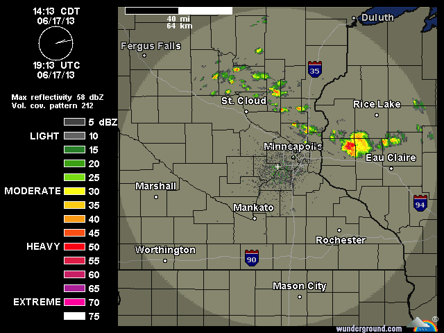
The heaviest thundershower, indicated in red, west of Eau Claire, Wis., at 2:12 p.m. CDT, produced some gusty winds and hail as it moved east across the St. Croix River into west central Wisconsin earlier this afternoon.
Storm reports for the past 24 hours.

You can see the clouds are less dense in southern Minnesota, allowing the temperatures to climb to near 80 F.
Turn Up Your Support
MPR News helps you turn down the noise and build shared understanding. Turn up your support for this public resource and keep trusted journalism accessible to all.
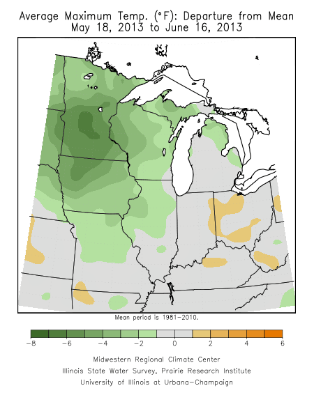
Gardeners will welcome the warmer temperatures expected as we move through the week. Maximum temperatures have struggled to reach 80 F. The high of 86 F at the Twin Cities International Airport on Sunday was the first reading of 80 F or higher in June.
Sunday's rainfall in northeast Minnesota tallied from a quarter to as much as a half inch. Not great timing, but welcome nonetheless. Over four-tenths of an inch of rain was measured at the National Weather Service in Duluth.

Although storms rumbled across the greater Twin Cities Metro area early Sunday evening, rainfall amounts were less than a quarter inch.
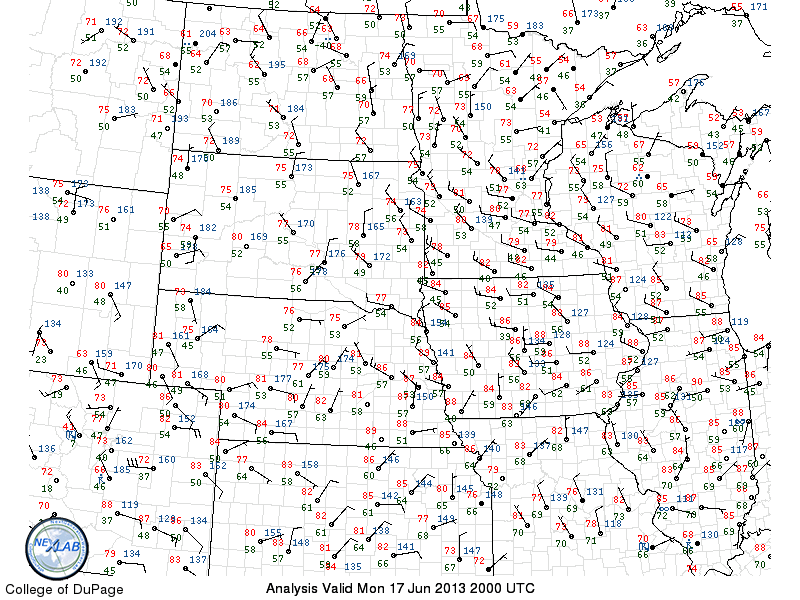
The surface weather map at 3 p.m. CDT showed a weak convergence of the winds associated with the development of the scattered showers. The numerals in red indicate the surface air temperature. It was chilly along the shoreline of Lake Superior.
click to enlarge image
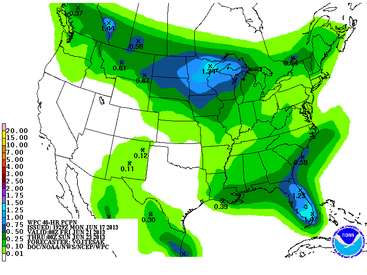
Warmer temperatures, more typical of summer, look to arrive later in the week and into the weekend. Along with the heat is likely to come some humidity and increasing chances for thunderstorms.
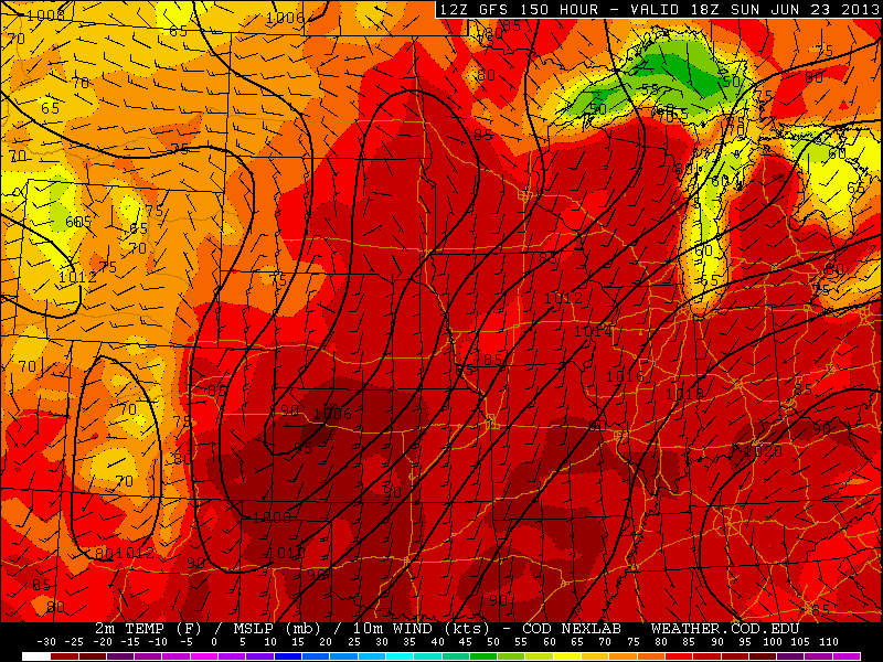
Thunderstorms could hamper outdoor activities on the weekend. I hate to throw cold water on your party, but be prepared for bouts of showers Friday night through Sunday.
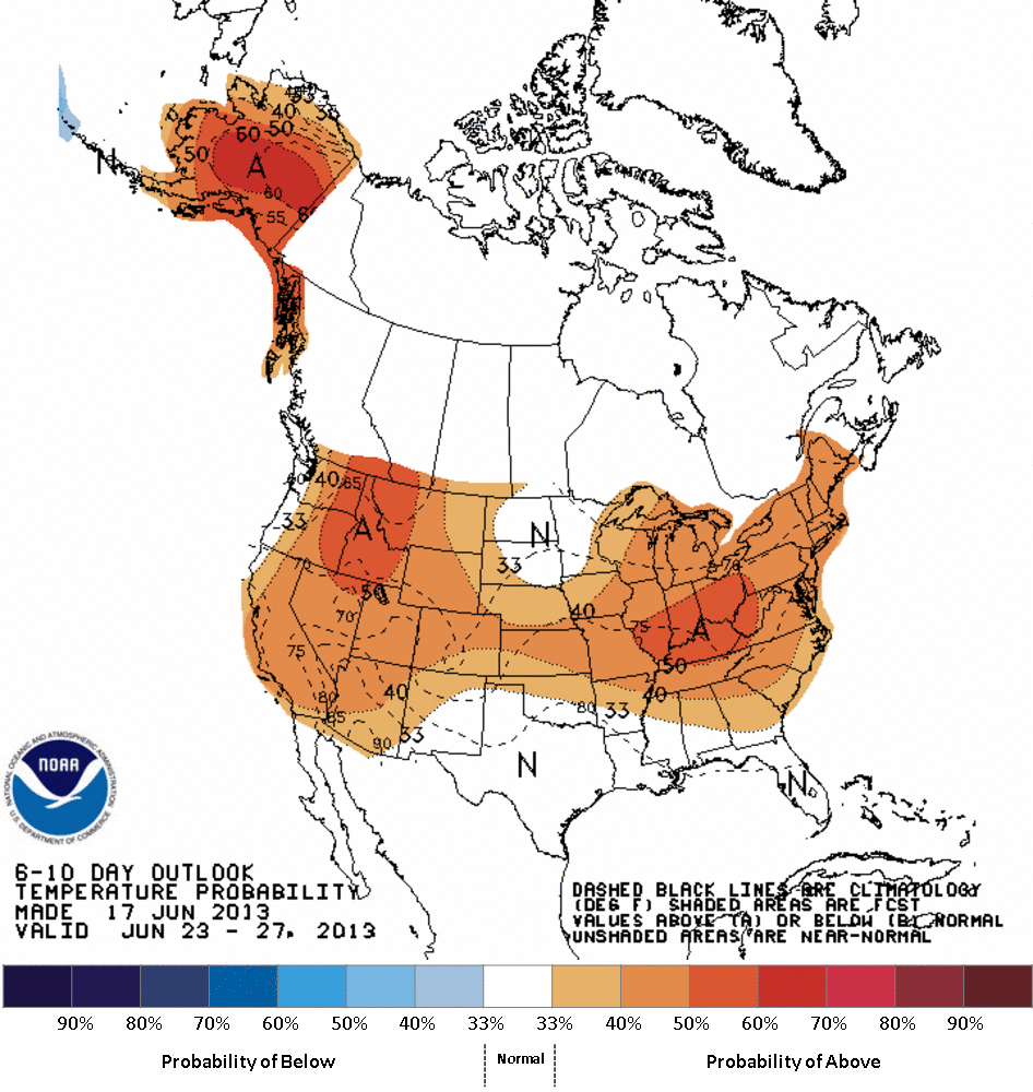
NOAA's Climate Prediction Center forecast normal temperatures next week.
Enjoy the middle part of the week as rain chances appear to be at their lowest.

