
Rounds of storms are coming
Go Deeper.
Create an account or log in to save stories.
Like this?
Thanks for liking this story! We have added it to a list of your favorite stories.


Today has been a pleasant day just about all across Minnesota. One lonely area of thunderstorms has developed along the Canadian border near International Falls but that's about it so far.
If you look closely at the sky, though, you will see that our daytime cumulus clouds look a bit unsettled. They have been towering a bit more than usual. That can be an indicator of an increasingly unstable atmosphere moving in. On the weather maps we are also watching a warm front approaching from the southwest with more heat and humidity as we head for the weekend. The weather satellite shows the warm front as a cloud band from South Dakota through southwestern Minnesota to Iowa:
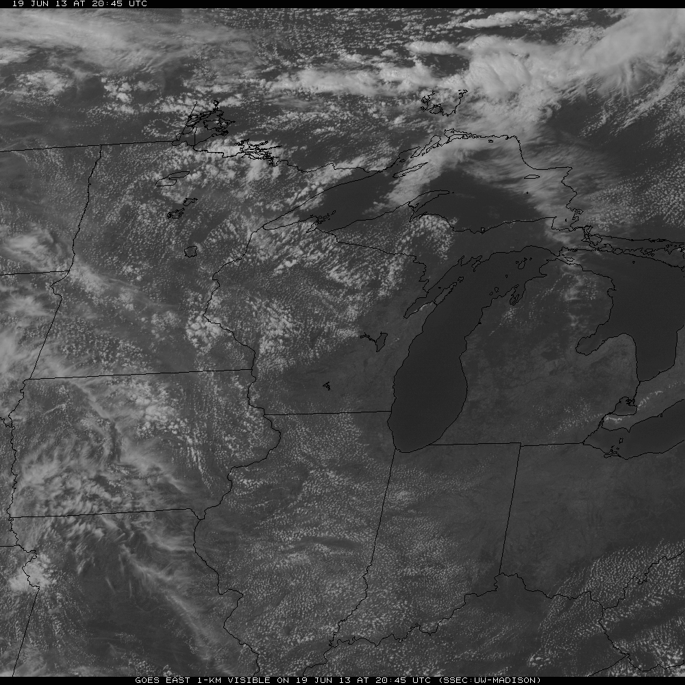
Click to view a loop of the eight most recent images.
Isolated thunderstorms are likely to pop up across Minnesota this evening and increase overnight as they spread eastward. Severe weather is not likely.
Turn Up Your Support
MPR News helps you turn down the noise and build shared understanding. Turn up your support for this public resource and keep trusted journalism accessible to all.
Tomorrow, however, could become an interesting day as the atmosphere over Minnesota grows increasingly unstable and thunderstorms become more numerous and larger. There will be a chance of severe weather in all of Minnesota except the tip of the Arrowhead. Here is how the Storm Prediction Center maps it out from 7 a.m. Thursday through 7 a.m. Friday:
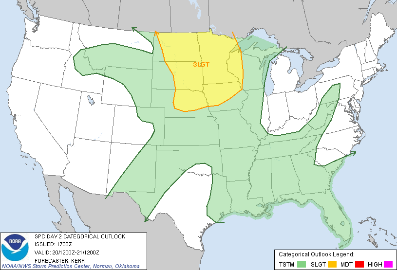
The best chance for severe storms is likely to be tomorrow evening and especially overnight into early Friday when a large MCS (mesoscale convective complex) might roll in from the Dakotas.
After that, Friday could be a replay of Thursday. Friday will be a hotter, more humid day with dewpoints pushing 70F across southern Minnesota. Thunderstorms like to form along boundaries such as fronts and old storm outflow boundaries, so what happens on Friday will depend at least in part on where the outflow boundaries from the Thursday/Thursday night storms end up.
As an early look ahead, here is what the NAM model computes out for precipitation for the three hours ending at 7 p.m. Friday:
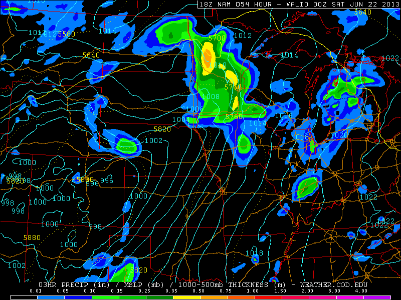
So be on the alert late on Friday and then Friday night.
The weekend forecast calls for periods of showers and thunderstorms, some with heavy rain and some possibly severe, right through Sunday. So timing will be everything for your outdoor activities.
There is a chance of showers and storms for Grandma's Marathon on Saturday but they will be too spotty for a confident forecast now. A light wind probably will be blowing in from chilly Lake Superior.
Soggy weather will continue in our parts well into next week. One model of forecast precipitation over the next week is below. These might be conservative forecasts if rains return repeatedly to the same locations.
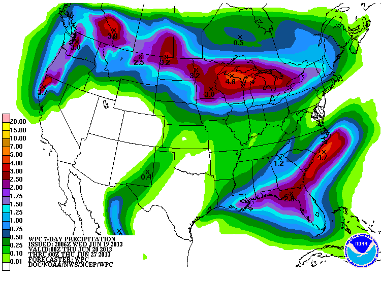
Oh well, at least our rhubarb garden will appreciate the rain.

