
A new month and a fresh start

Go Deeper.
Create an account or log in to save stories.
Like this?
Thanks for liking this story! We have added it to a list of your favorite stories.


The third consecutive soggy month for Minnesota has come to an end. I measured 6.11 inches of rain in my backyard rain gauge in Minneapolis during June. That was about an inch more than fell at the international airport but a bit less than what the National Weather Service measured at their office in Chanhassen. Other totals for the month include 6.86 inches in Rochester, 5.76 inches in Saint Cloud, 4.54 inches in Duluth and 7.73 inches in Fargo, North Dakota. One dry spot was International Falls with just 1.60 inches.
The heat wave in the western US has been big news recently, especially with the extreme heat and tragic wildfires in the Southwest. Las Vegas tied an all-time record high temperature for any date when it reached a temperature of 117 on Sunday. Other particularly toasty spots included Phoenix with 115, Zion National Park 112, Needles, California, 122 and Death Valley 128. Farther north, Salt Lake city warmed to 103 and even Seattle reached 93.
There also have been many forest fires burning in Canada. Most of them have been burning in uninhabited areas, but the smoke drifted southward across Minnesota on Sunday and gave us a bit of a hazy sky. That haze is still around this Monday morning and treated us early-risers to a blood red sunrise.
The sun also showed some geomagnetic activity last week and over the weekend. Here is what it looks like through excellent telephoto optics:
Turn Up Your Support
MPR News helps you turn down the noise and build shared understanding. Turn up your support for this public resource and keep trusted journalism accessible to all.
The geomagnetic activity has been responsible for northern lights that light up northern skies after the sunlight finally fades for the day. The auroras have been visible across Canada and many parts of the northern US the past few nights.

Today will be a lovely day under dry high pressure.
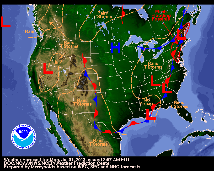
Highs today will range from the mid 70s across northern Minnesota to the mid 80s in the south. Dew points will remain low. There might just be enough energy to kick off a few isolated showers across central and southern Minnesota late this afternoon into this evening.
The rest of the week should be mostly dry and seasonably warm. Independence Day looks great. Temperatures should turn a little warmer and more humid later in the week. Then the weekend will bring a chance of thunderstorms, mainly later Saturday and on Sunday.

