Strong thunderstorms usher in cooler temperatures
Go Deeper.
Create an account or log in to save stories.
Like this?
Thanks for liking this story! We have added it to a list of your favorite stories.


National Night Out turned into meet your neighbor in the basement in many places across central Minnesota and west central Wisconsin last evening. Thunderstorms erupted in the heat and humidity on Tuesday afternoon and spread west to east.
Hail up to more than two inches in diameter pounded a path from about Morris, Minn., to the southeast sections of the Twin Cities metro. An additional hail track can be seen with the storm that traveled from south of Mille Lacs Lake to about Rice Lake, Wis.
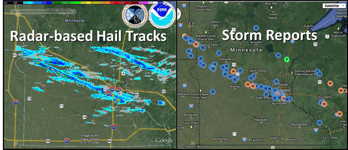
A detailed storm report can be found here.
The Chanhassen National Weather Service Office posted an examination of the radar display and storm reports that includes the track of the hail producing thunderstorms.
Turn Up Your Support
MPR News helps you turn down the noise and build shared understanding. Turn up your support for this public resource and keep trusted journalism accessible to all.
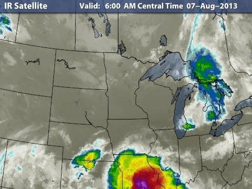
The infrared satellite image from daybreak depicts quiet weather over the Upper Midwest with a large cluster of thunderstorms producing flash flooding across southern Missouri.
Clouds are forecast to decrease today. Cooler temperatures are on tap for this afternoon, compared to the middle 80s in southern Minnesota on Tuesday afternoon.
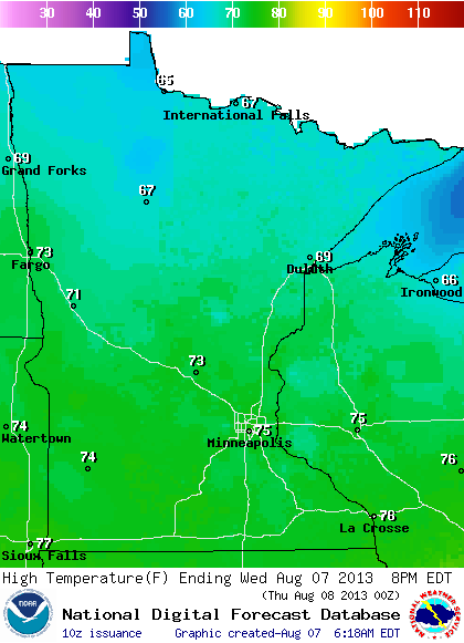
A chance for showers returns on Thursday before another surge of cooler air arrives for Friday extending into the weekend. If you are headed to the Northland you may wish to bring a sweatshirt.
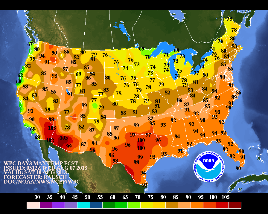
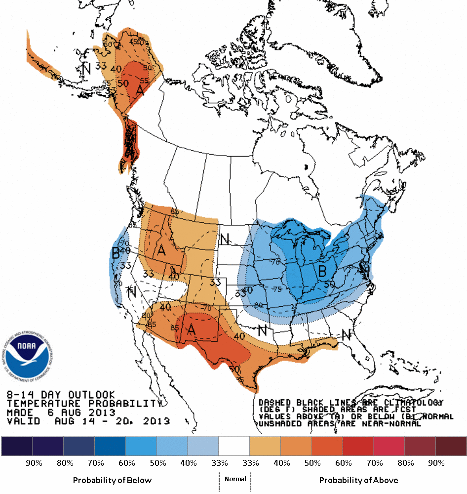
NOAA's monthly outlook whiched favored cooler than normal temperatures for August appears to stay on track as we look out through the middle of the month.