
Tracking the next weather system; a mild mid-November?
Go Deeper.
Create an account or log in to save stories.
Like this?
Thanks for liking this story! We have added it to a list of your favorite stories.


It will be a quiet weather day in our neck of the woods with temperatures remaining below seasonal normals.
The next rain/snow weather system is showing up on the weather map in the Pacific Northwest this morning. The nearly zonal flow (weather moving from west to east) should take the precipitation through northern Minnesota on Friday evening.

The national weather map depicts the potential for some snow to track across the Arrowhead on Friday night.
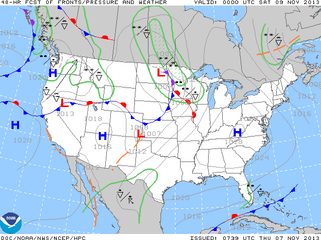
Snowfall from Friday evening to daybreak on Saturday could tally as much as four inches in far northern Minnesota.
Turn Up Your Support
MPR News helps you turn down the noise and build shared understanding. Turn up your support for this public resource and keep trusted journalism accessible to all.

Once this system moves through, you can expect winds to shift to the northwest and be quite brisk during the day on Saturday. Afternoon temperatures will be rather nippy in northern Minnesota.

Cool temperatures are expected into early next week.
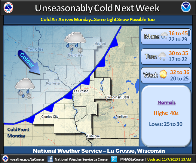
Looking out a ways, which is risky this time of year, the outlook suggests we will experience milder than normal temperatures in the middle of November.
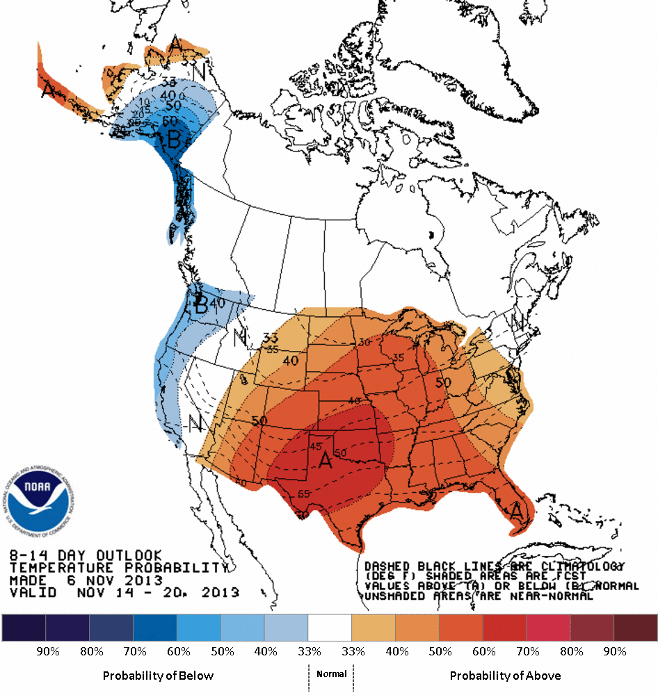
Remember this image depicts a confidence level of temperatures favoring above normal for the period, not the magnitude above normal.

