
Bitter cold this morning; snow accumulates today and tonight
Go Deeper.
Create an account or log in to save stories.
Like this?
Thanks for liking this story! We have added it to a list of your favorite stories.


Temperatures fell to as cold as 34 below zero at International Falls, Minn., overnight, with a low of 32 below zero at Bemidji, Minn., 30 below zero at Brainerd, Minn., and 21 below zero at Hayward, Wis. These temperatures were slightly colder than Monday morning's arctic cold.

The thermometer was a shivering 28 below zero at Hibbing, Minn., at 6 a.m. this morning. A wind chill advisory remains in effect this morning for much of Minnesota.
Snow is increasing in coverage in the Dakotas as we approach sunrise. Travel in eastern Minnesota should be okay through the morning hours. Falling snow is expected to slicken roadways later today and into the evening. Travel with caution.
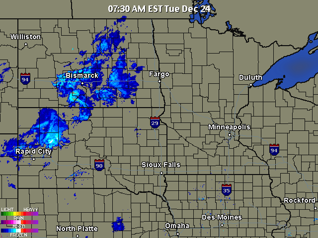
The broad area of snow is likely to leave behind an accumulation of 2 to 4 inches as it travels across Minnesota in the next 18 hours.
Turn Up Your Support
MPR News helps you turn down the noise and build shared understanding. Turn up your support for this public resource and keep trusted journalism accessible to all.
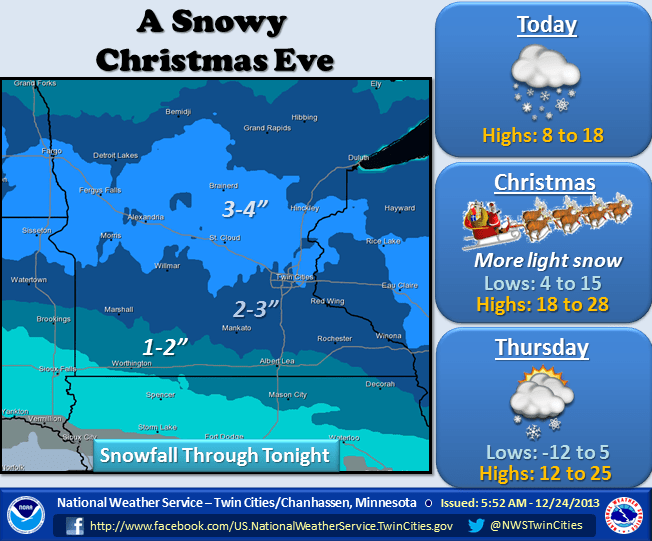
The Weather Prediction Center places the highest probability of at least 4 inches of snow with this system through west central Minnesota.

You can track the developing snowfall and the winter weather advisories at this link to the National Weather Service.
[image]
Brisk winds will likely result in some blowing and drifting snow through Christmas Day.
I probably over promised on high temperatures for Christmas as another shot of arctic air spills across the Canadian border early Christmas morning.

It is likely to remain rather cold on Thursday, but a push of milder air allows for some outdoor recreation on Friday through Saturday morning. Another jolt of bitterly cold air arrives on Sunday.


