
Warm and breezy Sunday; Monday shower chance
Go Deeper.
Create an account or log in to save stories.
Like this?
Thanks for liking this story! We have added it to a list of your favorite stories.


Our Saturday high temperature of 73 degrees at Minneapolis-St. Paul International Airport was a new record high for Nov. 5.
It was also 25 degrees warmer than our normal high of 48 degrees.
That's not a bad way to start a November weekend!
Records highs were also set Saturday in Duluth (70 degrees) and Rochester (71 degrees). St. Cloud tied their record high of 72 degrees.
Turn Up Your Support
MPR News helps you turn down the noise and build shared understanding. Turn up your support for this public resource and keep trusted journalism accessible to all.
Warm Sunday
Highs near 70 are expected over southern and central Minnesota this Sunday afternoon, and some records could be tied or broken:
Our projected high of 70 in the Twin Cities would be shy of our record of 73 degrees, but St. Cloud and Duluth could reach new record highs.
It will be breezy this afternoon, as a low pressure system moves into the Dakotas:

Monday rain chance
A cool front and upper level disturbance will bring a chance of showers to Minnesota on Monday, but any rainfall amounts should be light.
The National Oceanic and Atmospheric Administration’s North American Mesoscale 4 km resolution forecast model shows the Monday shower activity:
Our chance of a shower in the Twin Cities metro area would be mainly Monday afternoon.
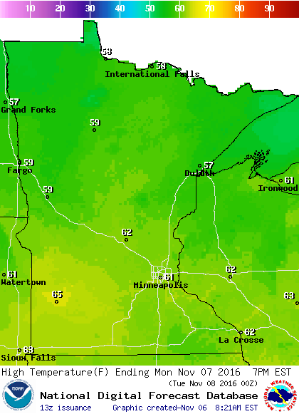
Highs on Monday will be cooler than Sunday's highs, but still a bit warmer than normal:
Election day weather
We aren't expecting any rain or snow in Minnesota on Election Day.
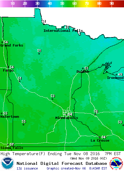
Highs on Tuesday will be in the 50s across Minnesota:
High-pressure systems will bring pleasant weather to most of the western states, as well as the east coast.
The Tuesday morning weather map shows showers are possible from Missouri to Michigan:
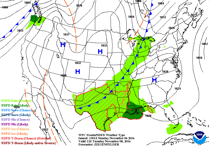
Southeastern Wisconsin could see an early morning shower.
The most widespread rains would tend to be from Texas into Mississippi.
Still waiting for 32 degrees
The temperature at Minneapolis-St. Paul International Airport hasn't reached 32 degrees or colder this autumn.
According to the Minnesota State Climatology Office:
The last time a first freeze went into November was 1958, when the first 32 degrees or colder was November 6.
Frost statistics can be difficult to compare due to the fact that for a good part of the Twin City observing history, the official thermometer was on top of a building in downtown Minneapolis, or on top of the old Wold Chamberlain building at the airport.
The heights ranged from 105 feet above the ground in downtown Minneapolis, to 32 feet above the ground at the International Airport. This would in effect cause the official temperature to miss some of the calm clear nights when cooler air would settle closer to the ground.
From 1891 to 1959 when the thermometer was on top of a building, there are three times when the first frost date was in November, with the latest on November 7, 1900.
Although we haven't seen 32 degrees or colder at Minneapolis-St. Paul International Airport this autumn, some spots in the Twin Cities metro area have dipped to 32 degrees or colder.
Frost has already been spotted at times in the metro area this autumn.
MPR News meteorologist Bill Endersen reported frost on his south Minneapolis lawn on Oct. 8 and 9. I also saw frost both of those mornings on my lawn in St. Paul.
When the air is calm or the winds are very light, the temperature at ground level can be several degrees colder than the temperature that is measured several feet above the ground.
Programming note
You can hear my live weather updates on Minnesota Public Radio at 7:35 a.m. and 4:35 p.m. each Saturday and Sunday.

