
Plenty of sunshine, mild temps
Go Deeper.
Create an account or log in to save stories.
Like this?
Thanks for liking this story! We have added it to a list of your favorite stories.


The low temperature at Minneapolis-St. Paul International Airport dropped to 34 degrees this Saturday morning.
This is the 214th consecutive day that the official Twin Cities temperature has stayed above 32 degrees, which is a new record.
We should be able to add at least 6 more days to that record before the official Twin Cities temp dips to 32!
Sunny and mild weekend
Turn Up Your Support
MPR News helps you turn down the noise and build shared understanding. Turn up your support for this public resource and keep trusted journalism accessible to all.
A high pressure system to our southeast will give us a breezy Saturday, with a bit less wind on Sunday as the high pressure system moves away:

A weak cold front moves through Minnesota Sunday evening.
Our Saturday highs will range from the lower 50s over northeastern Minnesota to upper 50s over the southwest:
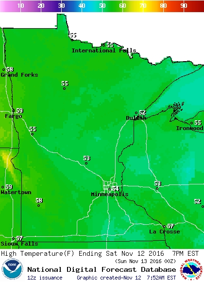
A few spots in southwestern Minnesota could touch 60 degrees.
Highs on Sunday will be even warmer:
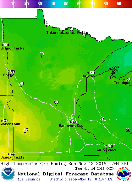
We could see 60 degrees in the Twin Cities on Sunday, which is way above our average high of 43 degrees.
We're expecting highs in the 50s this coming week in the Twin Cities.
First snowflakes
According to the Minnesota State Climatology Office, the average date of our first one inch or greater snowfall in the Twin Cities is November 18th.
We've seen our first one inch snowfall of the season as early as September 26th, in 1942.
Imagine how strange it seemed in the winter of 1944-1945, when the first one inch snowfall of the season didn't occur until January 9th!
Why are we talking about snow?
The Global Forecast System model of the National Weather Service shows a low pressure system over Minnesota this coming Thursday evening:
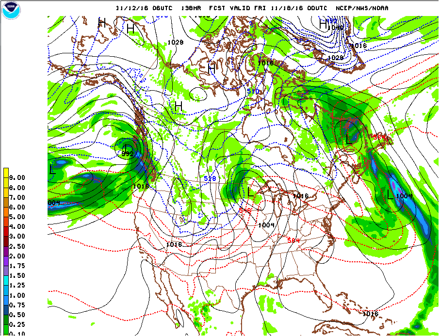
If this occurs, rain is possible over eastern Minnesota, with snow or a rain/snow mix over the northwest.
As the low moves northeastward Thursday night, snow would be possible over northern Minnesota, with rain changing to a mix or some wet flakes over the south.
We'll see if the forecast maps change as we get closer to Thursday, but right now it doesn't look like we'll see any significant snow accumulation in the Twin Cities Thursday night.
Programming note
You can hear my live weather updates on Minnesota Public Radio at 7:35 a.m. and 4:35 p.m. each Saturday and Sunday.

