
Cool with light winds; Tuesday snow
Go Deeper.
Create an account or log in to save stories.
Like this?
Thanks for liking this story! We have added it to a list of your favorite stories.


After very warm temperatures during the first half of November, Minnesotans are adjusting to a cool down.
Our average high temperature for November 2oth is 38 degrees in the Twin Cities.
We could see Sunday afternoon highs in the lower 30s over southern Minnesota, with cooler highs to the north:
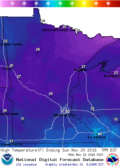
Winds will be much lighter than they were on Saturday.
Turn Up Your Support
MPR News helps you turn down the noise and build shared understanding. Turn up your support for this public resource and keep trusted journalism accessible to all.
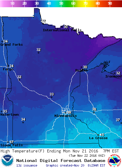
High temps on Monday will closer to normal, with upper 30s in the Twin Cities metro area:
Tuesday snow
Computer models still show a low pressure system tracking from Kansas to northern Illinois from Tuesday morning to Wednesday.
Here’s the latest storm track from NOAA’s Global Forecast System (GFS) model:
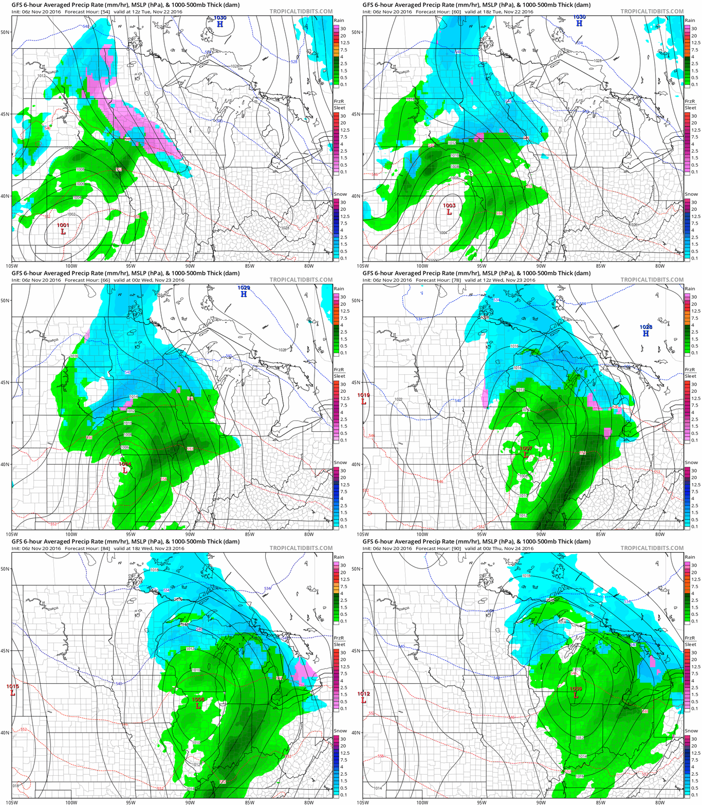
We could see rain or a rain/snow mix over southern Minnesota Tuesday morning, with snow over central and northern Minnesota.
The mix over southern Minnesota would tend to change to snow Tuesday afternoon or Tuesday evening.
The Twin Cities NWS has this summary of the snow potential:
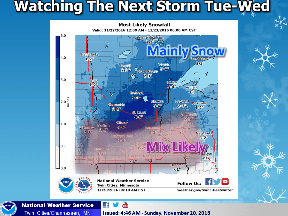
The highest snow totals could be in the 4-6 inch range, from about Willmar through St. Cloud and up to Lake Mille Lacs.
The far northwest corner of the Twin Cities metro area would be near the heaviest snow band.
We'll be watching the computer models for possible changes in the storm track. We'll also keep tabs on the timing of that change from the rain/snow mix to snow in southern Minnesota.
Programming note
You can hear my live weather updates on Minnesota Public Radio at 7:35 a.m. and 4:35 p.m. each Saturday and Sunday.

