
Heavy snow Friday afternoon into Saturday morning
Go Deeper.
Create an account or log in to save stories.
Like this?
Thanks for liking this story! We have added it to a list of your favorite stories.


We're getting close to our average December snowfall total in the Twin Cities, which is 11.5 inches. So far this month, we've tallied 9.6 inches at Minneapolis-St. Paul International Airport.
Some light snow is possible tonight into Friday morning, and it could cause some slick roads for Friday morning rush hour.
The main snow event will be from Friday afternoon into early Saturday morning, with some impressive snow amounts expected over much of southern and central Minnesota.
Here is a summary of projected snow totals, courtesy of the Twin Cities office of the National Weather Service:
Turn Up Your Support
MPR News helps you turn down the noise and build shared understanding. Turn up your support for this public resource and keep trusted journalism accessible to all.
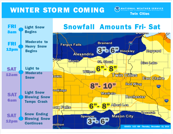
Most of the Twin Cities metro area is in the 8 to 10 inch category, with 6 to 8 inches over the far north metro.
Temperatures will be cold, so it won't be a wet snow, but the powdery snow will blow around as the winds pick up on Saturday.
Winter storm warning
A winter storm warning will be in effect from noon Friday to noon Saturday for most of the Twin Cities metro area, southern Minnesota and west-central Wisconsin:
A winter storm watch is in effect in the blue shaded areas to the north and south of the winter storm warnings.
Here is the simulated radar from noon Friday to noon Saturday, from the National Oceanic and Atmospheric Administration’s 4 km resolution North American Mesoscale forecast model:
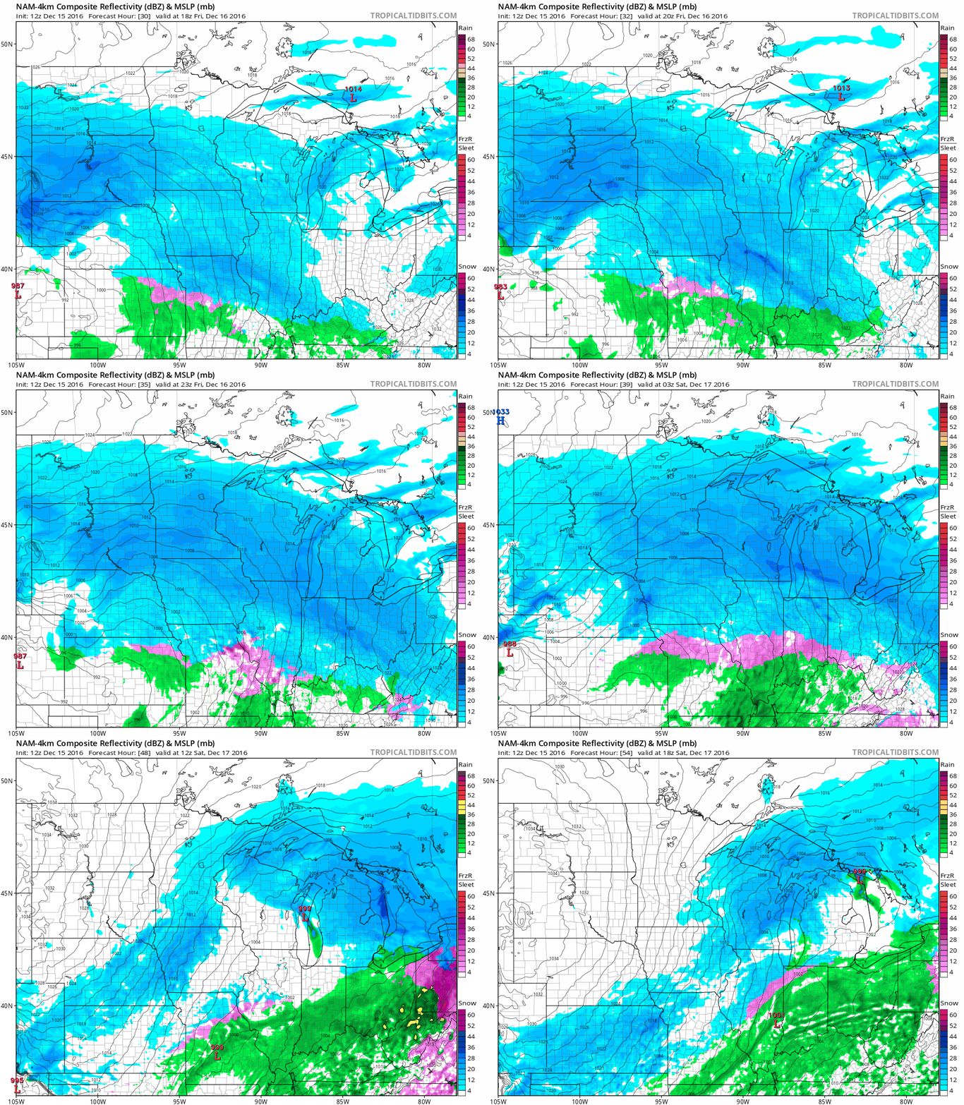
By the way, you can ignore the color chart for snow on the lower right. It shows the colors used for different signal strengths that return to the radar, not inches of snow!
December snow rankings
Even if we see 7 or 8 inches of snow by Saturday morning, we'll still have a long way to go to reach our December record in the Twin Cities. Here are our top ten snow totals for the entire month of December in the Twin Cities, according to the Minnesota State Climatology Office:
DECEMBER...
1. 2010............33.6 INCHES
2. 1969............33.2 "
3. 2000............30.2 "
4. 1968............28.7 "
5. 1950............25.0 "
6. 1902............24.0 "
7. 1996............23.7 "
8. 1927............22.8 "
9. 1983............21.0 "
10. 2009............20.9 INCHES
33.6 inches is a lot of snow in one month, since we average 54 inches during our entire snow season!
Cold and colder
We could almost say "cold until further notice".
Our average high is 27 degrees this time of year in the Twin Cities. Our high temp has been only 10 degrees the past two days.
Single digit highs are expected today.
Highs Friday will "warm" into the teens over southern Minnesota:

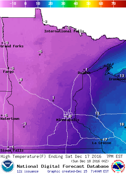
On Saturday, a reinforcing shot of cold air sweeps in from the north, with highs below zero over western and northern Minnesota:
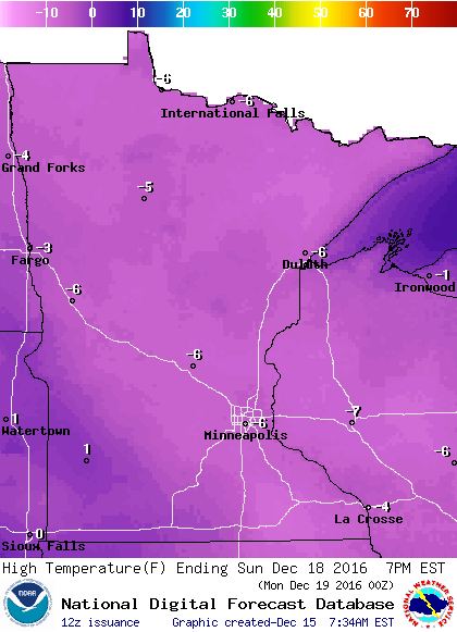
Sunday's highs will be below zero over most of Minnesota, including the Twin Cities:
The upper 20s in the forecast for Tuesday of next week will feel great!

