
Highs in the 30s Wednesday; much colder in early January
Go Deeper.
Create an account or log in to save stories.
Like this?
Thanks for liking this story! We have added it to a list of your favorite stories.


It was great to see sunshine this Tuesday afternoon!
We've had a lot of cloud cover lately, and we finally had an opportunity to see a sunset.
In the Twin Cities, our sunset is now 7 minutes later than it was on December 15.
That's a nice start, but we won't see sunsets at 5 p.m. until January 15.
Turn Up Your Support
MPR News helps you turn down the noise and build shared understanding. Turn up your support for this public resource and keep trusted journalism accessible to all.
By the end of January, the sun sets at 5:20 p.m. in the Twin Cities, and it sets at 6 p.m. at the end of February.
Our latest sunset are 9:04 p.m. CDT, during the third week of June.
Warmer
Highs on Wednesday will be 8 to 10 degrees above normal in Minnesota, with many spots popping into the 30s:

ntr
Parts of northern and central Minnesota will see some snow showers.
NOAA’s North American Mesoscale forecast model shows the snow showers to the north:

The color chart on the lower right of the loop refers to the strength of the radar signal returning to the radar, not inches of snow!
Cold air returns
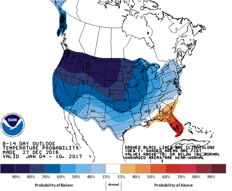
The extended outlook from NOAA's Climate Prediction Center shows a strong probability of below normal temperatures for the January 4 through January 10 period:
NOAA's Global Forecast System model shows single digit or below zero temps in the Twin Cities from January 4 through January 7, with a rebound on January 8:
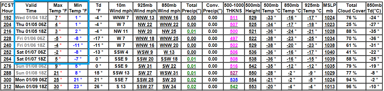
This looks like another episode of "the Polar vortex", but it should be shorter than the cold stretch that we saw this month.

