
Less wind on Friday; afternoon snow northern MN
Go Deeper.
Create an account or log in to save stories.
Like this?
Thanks for liking this story! We have added it to a list of your favorite stories.


We hit 33 degrees this Thursday afternoon at Minneapolis-St. Paul International Airport.
That's 9 degrees warmer than our average December 29th high temp, but it didn't feel very mild.
Brisk winds gave us wind chill temps in the teens throughout the afternoon hours.
Our Friday will be much less windy, but temps will be cooler.
Turn Up Your Support
MPR News helps you turn down the noise and build shared understanding. Turn up your support for this public resource and keep trusted journalism accessible to all.
Northern Minnesota will see highs in the teens Friday afternoon, with mostly 20s elsewhere:

Friday snow north
NOAA's North American Mesoscale forecast model shows snow spreading across northern Minnesota Friday afternoon and evening, and continuing into Friday night:
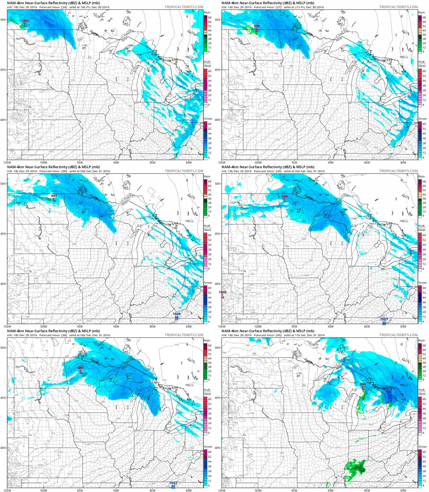
Parts of northern Minnesota could see several inches of snow late Friday into Friday night.
The color chart on the lower right of the loop refers to the strength of the radar signal returning to the radar, not inches of snow!
Quiet weekend
It looks like a fairly quiet weekend for Minnesota.
Saturday will be breezy, with highs ranging from the teens over northeastern Minnesota to lower 30s southwest:
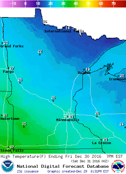
On New Year's Day, we'll have light winds and plenty of sunshine.
Central and southern Minnesota will see highs in the 30s on Sunday:
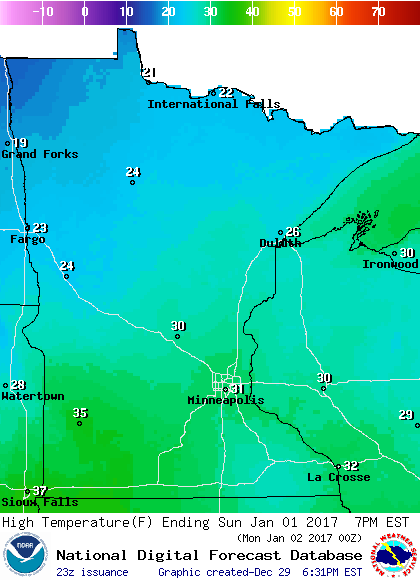
Temps will top out in the 20s over northern Minnesota.
Monday night snow
NOAA's Global Forecast System model still shows some snow over Minnesota Monday afternoon into Monday night:
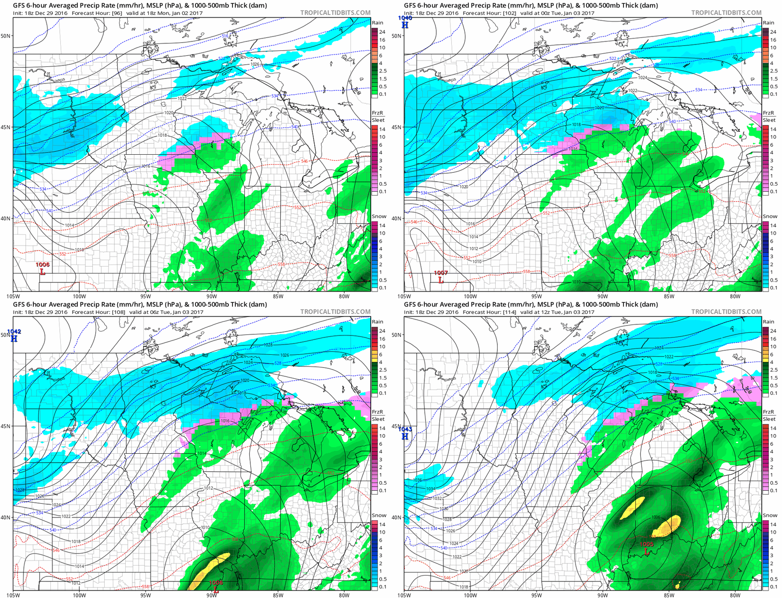
We will have enough new snow to shovel if everything comes together as depicted on the GFS model.
The European Centre for Medium-Range Weather Forecasts (ECMWF) model shows a stronger low pressure system and a more northerly storm track.
The ECMWF model solution would give us more snow than the GFS model.
Sharply colder next Wednesday
After the snow moves out next week, much colder air will surge southward out of Canada.
The GFS model shows afternoon temps only reaching about 9 degrees next Wednesday and Thursday in the Twin Cities:
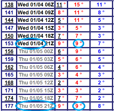
Our high next Wednesday in the Twin Cities might be around 1 or 2 in the morning!

