
Top weather events of 2016; Monday rain and snow
Go Deeper.
Create an account or log in to save stories.
Like this?
Thanks for liking this story! We have added it to a list of your favorite stories.


The Minnesota State Climatology Office has compiled a list of the Top Five weather events of 2016 in Minnesota.
The Climatology Office based the Top Five list on:
"votes cast from various weather enthusiasts including the National Weather Service, the University of Minnesota, State agencies and Facebook followers. "
Turn Up Your Support
MPR News helps you turn down the noise and build shared understanding. Turn up your support for this public resource and keep trusted journalism accessible to all.
The Top Five:
#1 State Record Precipitation Total at Waseca and Record Annual Twin Cities Precipitation.
#2 Central Minnesota Flash Flood July 11-12, 2016
#3 Severe Storms Strike Northland Again: July 20-21, 2016
#4 Tie for the warmest Autumn on record in Minnesota.
The Minnesota State Climatology Office had this to say about the weather event that was voted #1:
The event that garnered the most votes was the statewide annual precipitation record set at Waseca and the Twin Cities annual record precipitation. The preliminary 2016 precipitation total at Waseca is 56.24 inches, handily breaking the old record at St. Francis in Anoka County of 53.52 inches in 1991. The 2016 total at Waseca breaks the old record by 2.72 inches. The Twin Cities also broke the annual precipitation record that was set over 100 years ago. The preliminary total for 2016 is 40.32 inches, breaking the old record of 40.15 inches set in 1911. The precipitation record for the Twin Cities begins in 1871.
The streak of 16 consecutive months (September 2015 through December 2016) with above normal monthly temps in the Twin Cities was given honorable mention by the voters.
Some snow north tonight
Snow is expected to spread across parts of northern Minnesota this evening.
The National Oceanic and Atmospheric Administration’s North American Mesoscale forecast model shows the expected snowfall pattern:

The color chart on the lower right of the loop refers to the strength of the radar signal returning to the radar, not inches of snow!
Snowfall amounts are expected to be fairly light, but the snow could cause some slick spots on roads.
Here's a summary, from The Duluth office of the National Weather Service:

You can check with the Duluth office of the National Weather Service for snow updates this evening, and updated weather information is also posted on the MPR news live weather blog.
The Minnesota Department of Transportation has current road conditions.
Weekend temps
Highs today will be close to normal, with teens northeast and 20s elsewhere:
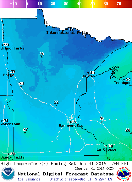
It'll be breezy today, with lighter winds on tap for Sunday.
Highs on Sunday will be mild for January 1, with highs in the 20s north and some lower 30s in the south:
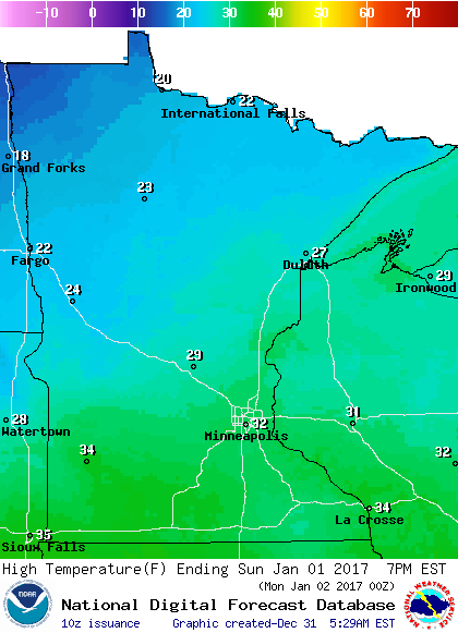
We're expecting our temps to take a sharp drop by the middle of next week, with single digit highs on tap for Wednesday through Friday. Morning lows are likely to dip below zero on Thursday and Friday.
Monday rain and snow
The National Oceanic and Atmospheric Administration’s Global Forecast System model still shows some snow over Minnesota from Monday into Tuesday.
The GFS model also shows that the precipitation could start as rain or freezing rain over southeastern Minnesota and the Twin Cities metro area:
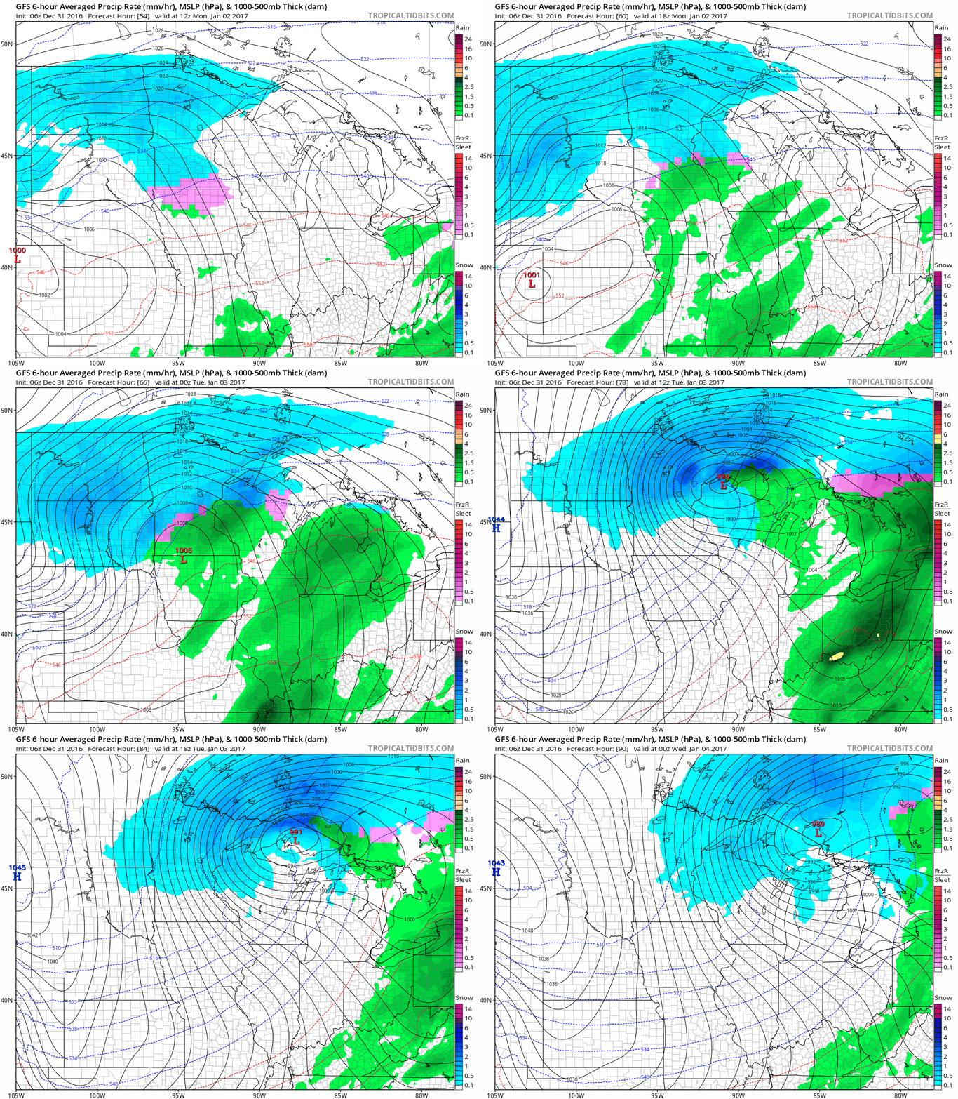
The mixed precipitation would change to all snow over the Twin Cities metro area and parts of southeastern Minnesota Monday night, and continue as snow into Tuesday.
The remainder of Minnesota would see mostly snow, and several inches of snow could accumulate.
We’ll be watching the forecast models closely as we get closer to Monday!
Programming note
You can hear my live weather updates on Minnesota Public Radio at 7:35 a.m. and 4:35 p.m. each Saturday and Sunday.

