A breezy lull before cold rain and wet snow
Go Deeper.
Create an account or log in to save stories.
Like this?
Thanks for liking this story! We have added it to a list of your favorite stories.


The first part of our current storm system arrived on Sunday with showers and thunderstorms. Strong storms produced quarter-size or larger hail in southeastern Minnesota including the Rochester area Sunday evening. Other reports were received of hail falling in various parts of Wisconsin.
Rain and some snow on Monday
Monday is beginning with a distinct lull in the action as we await meteorological reinforcements. An upper level wave approaching from the west will begin to trigger more rain this morning. A band of rain will develop from southwestern Minnesota to northwestern Wisconsin by this afternoon. Rain will then expand to cover about the southeastern half of Minnesota during the afternoon.
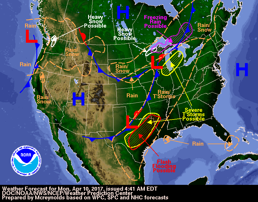
Today will be quite breezy with a gusty north wind statewide. Expect rather chilly temperatures in northern Minnesota and falling temperatures in the southern half of the state. The Twin Cities will see the temperature fall into the mid 30s this afternoon.
Turn Up Your Support
MPR News helps you turn down the noise and build shared understanding. Turn up your support for this public resource and keep trusted journalism accessible to all.
April snow
Falling temperatures will change some of that rain to a rain/snow mix or all wet snow. The best chance of a skimpy layer of snow mainly on grassy areas will be in east central Minnesota this evening as temperatures fall closer to freezing.

Greater snowfall is likely in northwestern Wisconsin where temperatures will be cooler while precipitation continues to fall. A winter weather advisory has been posted for that area for this afternoon and tonight. Accumulations of 2 to 4 inches of wet snow are likely, especially in far northern Wisconsin around Ashland.

Tuesday sunshine
Dry high pressure will build into Minnesota on Tuesday and bring clearing skies from west to east. High temperatures should range from the upper 40s to the upper 50s. The Twin Cities will have a morning low around 31 and a sunny afternoon high of about 53.
Next chances of rain
Current forecast models are bringing showers our way on Wednesday and Wednesday night. The next chance of thunderstorms is likely to be later on Friday.
Looking deeper into April
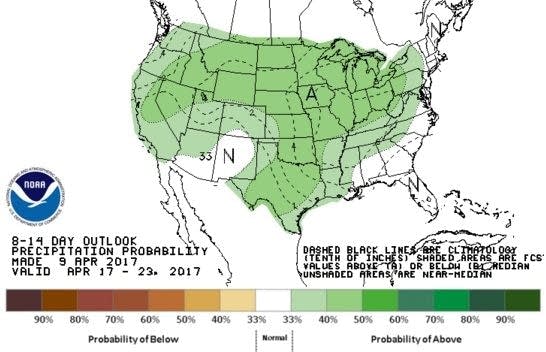
Long-term models are forecasting a tendency for much of the country, including Minnesota and all of the central U.S., to be wetter than normal during April 17-23.