
Plenty of sunshine, with a warming trend
Go Deeper.
Create an account or log in to save stories.
Like this?
Thanks for liking this story! We have added it to a list of your favorite stories.


Monday's cold temps, rain and fat snowflakes are now a distant memory. Bright and warmer weather is on the way.
You'll probably see a lot of people walking by in T-shirts, shorts and possibly flip-flops over the next few days. This is the type of May weather that we can embrace!
Dry stretch
The National Oceanic and Atmospheric Administration’s North American Mesoscale forecast model shows very little rain today or Friday.
Turn Up Your Support
MPR News helps you turn down the noise and build shared understanding. Turn up your support for this public resource and keep trusted journalism accessible to all.
There could be some scattered showers over northeastern Minnesota and western Wisconsin late Friday:

This weekend looks dry, and the first chance of rain next week will be late Monday into Tuesday.
Warming trend
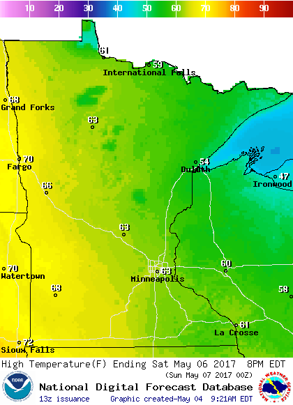
Highs today will be in the 60s over most of Minnesota, with a few spots in southern Minnesota and the Twin Cities metro area touching 70 degrees. Parts of northeastern Minnesota might top out in the 50s.
Our average high this time of year is 66 degrees in the Twin Cities.
Most of Minnesota will see highs in the 70s on Friday:

Saturday will feature a lot of highs in the 60s, with some 50s over northeastern Minnesota:
The Twin Cities metro area will see highs in the 60s on Sunday, lower 70s Monday, then mid 70s Tuesday.
Increasing sunshine
We typically see more sunny days as we go from winter through spring and into summer.
In the Twin Cities, we average 61% of possible sunshine during the month of May:
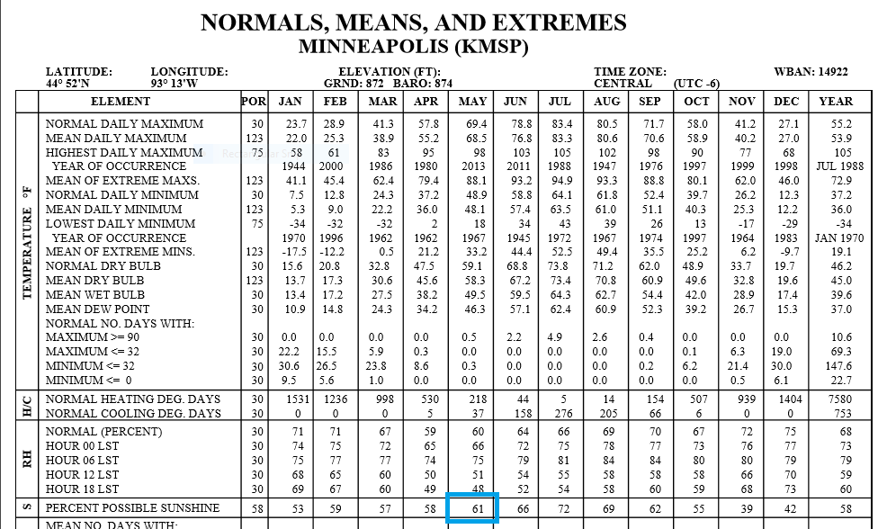
November is typically our cloudiest month, with only 39 percent of possible sunshine.
As you might imagine, July is typically our sunniest month in the Twin Cities, with an average of 72 percent of possible sunshine.
There's a good reason that many people take their lake vacations or Minnesota road trips in July!
Lightning data
GOES-16, the newest United States weather satellite, is still undergoing testing. It's already sending us some interesting new products.
Here's some lightning data from last weekend
Lightning data will be valuable to meteorologists as we track the strength of thunderstorms.
Programming note
You can hear my live weather updates on Minnesota Public Radio at 7:49 a.m. Thursdays and Fridays, and at 7:35 and 9:35 a.m., plus 4:35 p.m., each Saturday and Sunday.

