
A mostly-lovely week is on its way
Go Deeper.
Create an account or log in to save stories.
Like this?
Thanks for liking this story! We have added it to a list of your favorite stories.


If you are a fan of comfortable temperatures, low humidities and just a few stray showers, then this will be your kind of week.
Weather maps show a low-pressure center over the Dakotas with a warm front approaching southwestern Minnesota and extending into Iowa. These features will trigger scattered showers and thunderstorms, but the low humidities in place across Minnesota will keep rainfall to a minimum today and tonight.
The areas most likely for a few showers and thunderstorms will be the northwestern and southeastern portions of the state late today.
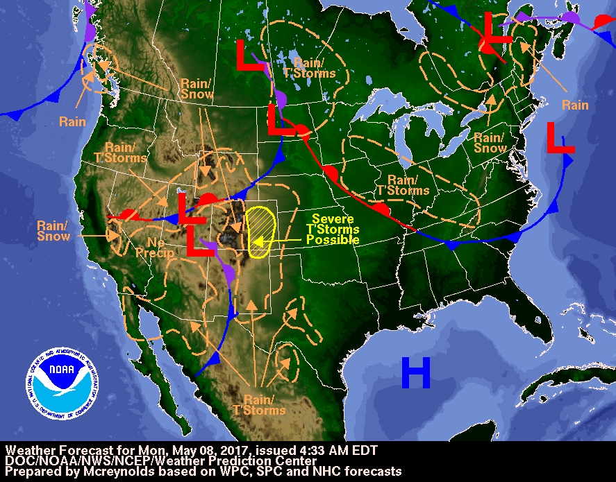
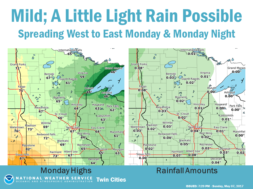
High temperatures will have a large range across the state this afternoon. Grand Marais and all along Minnesota's North Shore will have highs just in the mid 40s, thanks to a breeze off Lake Superior, while the southwestern corner of the state near the warm front should warm to the low or mid 80s.
Turn Up Your Support
MPR News helps you turn down the noise and build shared understanding. Turn up your support for this public resource and keep trusted journalism accessible to all.
For the Twin Cities area, Monday will be partly cloudy with highs in the upper 60s. There is a chance of thunderstorms this evening or early tonight. Severe weather is unlikely and rainfall amounts should be minimal. The normal low and high temperatures for the Twin Cities today and 47 and 67. Sunset will be at 8:27 p.m.
Here is the weather story from the National Weather Service:
Tuesday through Friday
The remainder of the work week should be rain-free for Minnesota and with a smaller temperature spread. High temperatures are forecast to be mainly in the 60s to low 70s but a bit cooler along the North Shore.

Weekend
The weekend forecast is fuzzy at this time range, but a weak disturbance might kick off a few showers on Saturday. Sunday is likely to be dry and pleasantly warm for Mother's Day.

