

Heavy rains drench an already soggy northern Minnesota
Like this?
Log in to share your opinion with MPR News and add it to your profile.
Like this?
Thanks for liking this story! We have added it to a list of your favorite stories.
Updated 12:10 p.m. | Posted 8:48 a.m.
Torrential rains swept across parts of northeast and east-central Minnesota early Thursday morning, dumping more than 6 inches of rain on areas already soaked by recent storms. The rain fell as quickly as 2 inches an hour in some Iron Range locations.
The National Weather Service in Duluth says radar showed very heavy rain from Tower to Cook.
Support the News you Need
Gifts from individuals keep MPR News accessible to all - free of paywalls and barriers.
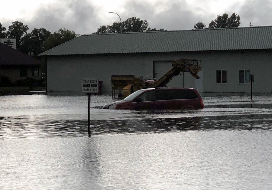
As of 8:30 a.m., the Mora airport had received more than 6 1/2 inches of rain. Roads in Mora were closed and authorities reported cars stranded by high water.
Roads were reported washed out near Cook and in Pine River. There were also reports of flooding on U.S. Highway 169 in Hill City.
The downpour prompted a sharp rise of the Mississippi river gauge in Aitkin. Staff at an assisted living center in Aitkin reported water pouring into the facility through leaks in the windows and the roof.
"In some cases in southern Aitkin County, they received 4 to 5 inches in just about two hours," said Joe Moore, a meteorologist with the National Weather Service in Duluth. "And of course, those are isolated spots, but a lot of this area received an extreme amount of rainfall."
A flash flood warning was issued for parts of central Minnesota. The rain is subsiding and moving into Wisconsin, but authorities say drivers should be prepared to encounter unexpected flooding and road damage, and they should avoid standing or moving water.