
Scattered Sunday showers for some areas; cool temps this week
Go Deeper.
Create an account or log in to save stories.
Like this?
Thanks for liking this story! We have added it to a list of your favorite stories.


After a glorious weather day on Saturday, we'll see cooler temperatures today. Some of us will also see a few showers.
On to the details.
Temperature trends
Sunday afternoon highs are expected to range from the upper 40s in the far northwestern corner of Minnesota to lower 60s in the far southeast.
Turn Up Your Support
MPR News helps you turn down the noise and build shared understanding. Turn up your support for this public resource and keep trusted journalism accessible to all.
There will be a lot of highs in the 50s on Monday:
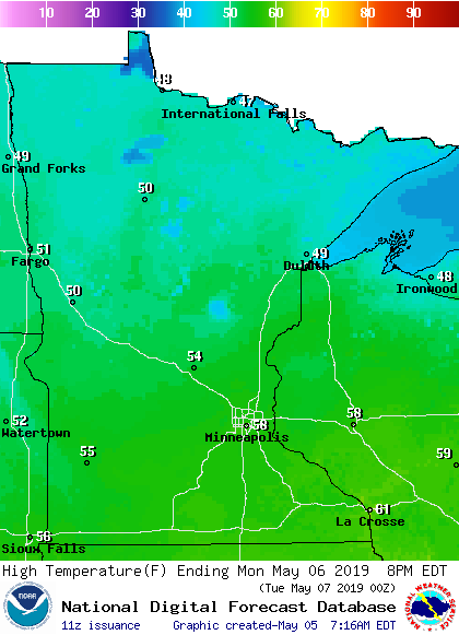
A few spots in the Twin Cities metro area will touch 60 degrees Monday afternoon, but that'll still be cooler than our average May 6 high temp of 67 degrees.
Metro area high temps are projected to be in the lower 60s Tuesday, followed by lower 50s Wednesday, mid 50s Thursday and around 60 on Friday.
The Climate Prediction Center of the National Weather Service shows that cooler-than-normal temperatures are likely for the May 10 through May 14 time period:
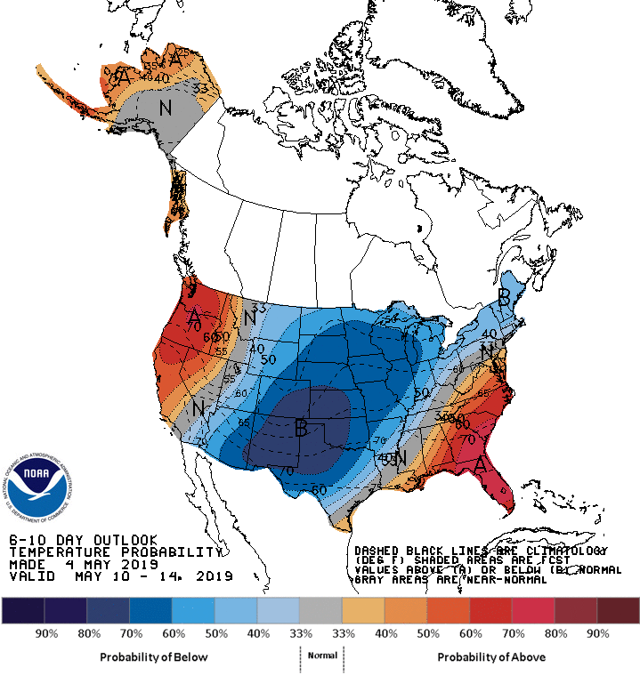
We probably won't be needing our air-conditioners the next 10 days!
Rain chances
It was raining across much of central Minnesota and northwestern Wisconsin this Sunday morning. The rain area will spread southward and become more scattered later Sunday morning into early afternoon. Some locations in the Twin Cities metro area could see a few minutes of showers. Far southern Minnesota might see another batch of scattered showers develop later Sunday afternoon into Sunday evening.
As always, updated weather information can be heard on the Minnesota Public Radio Network, and you’ll also see updated weather info on the MPR News live weather blog.
Periods of rain are expected in much of southern Minnesota and portions of Wisconsin Wednesday and Wednesday night, with a thunderstorm also possible. A few lingering showers are possible Thursday morning.
The National Oceanic and Atmospheric Administration’s Global Forecast System model shows the potential precipitation pattern Wednesday through Thursday afternoon:
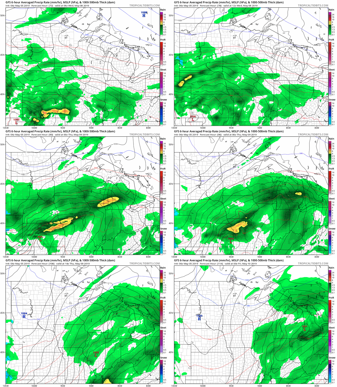
The color chart to the right of the loop refers to the precipitation rate (mm per hour), not to the total amount of rain.
Warmer days ahead
We're expecting below-normal high temps for the next week to ten days, but there should be plenty of warm days ahead. It might help to note that the average high temp in the Twin Cities metro area is 74 degrees on June 1, and it’s 83 degrees on July 1.
Programming note
You can hear my live weather updates on Minnesota Public Radio at 7:49 a.m. Thursdays and Fridays, and at 7:35 a.m., 9:35 a.m. and 4:35 p.m. each Saturday and Sunday.

