
Fairly nice Mother’s Day weather; a shot at 80 by Thursday
Go Deeper.
Create an account or log in to save stories.
Like this?
Thanks for liking this story! We have added it to a list of your favorite stories.


Agreeable weather is on tap for most of Minnesota and western Wisconsin this Mother's Day. Weather shouldn't interfere with outdoor plans in most areas.
On to the details.
Temperature trends
Sunday afternoon highs are expected to reach the lower 60s in much of Minnesota plus western Wisconsin. I wouldn't be surprised if a few spots in the Twin Cities metro area top out in the mid 60s. There will probably be some highs in the 50s along the North Shore of Lake Superior.
Turn Up Your Support
MPR News helps you turn down the noise and build shared understanding. Turn up your support for this public resource and keep trusted journalism accessible to all.
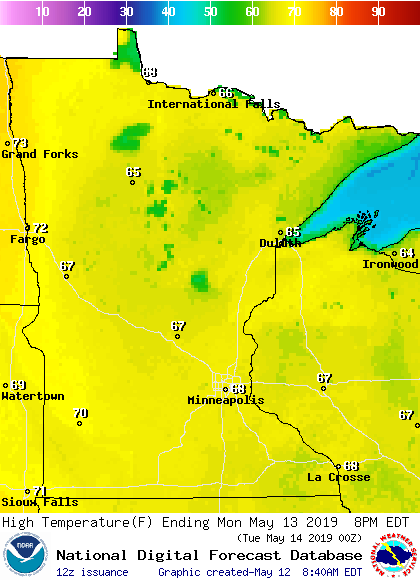
Monday high temperatures will be mainly in the 60s, with some lower 70s possible in southwestern Minnesota:
Much of central and southern Minnesota will see highs in the 70s on Tuesday:
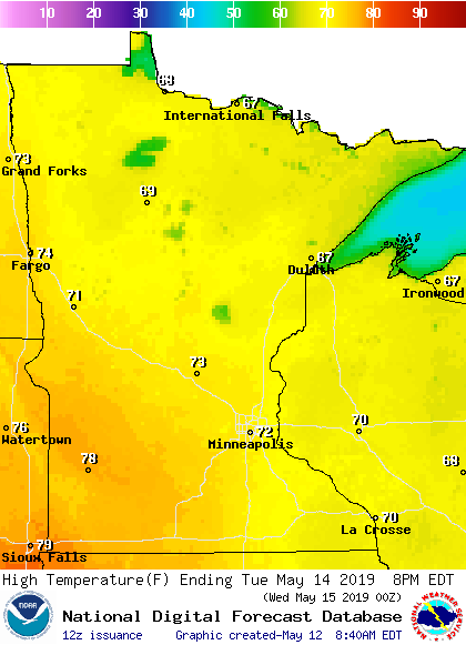
Twin Cities metro area high are projected to reach the mid 70s on Wednesday. It looks like the metro area will top out around 80 degrees on Thursday and Friday. The last time that the temperature reached 80 degrees at Minneapolis-St. Paul International Airport was September 17. That's almost eight months ago.
Rain chances
Parts of southwestern and south-central Minnesota saw some showers early Sunday morning. Those showers broke up by around mid-morning.
Most of Minnesota, plus west-central Wisconsin, will have a chance of an isolated shower Sunday afternoon and Sunday evening. If you see a shower, it shouldn't last very long. Scattered showers are possible Sunday afternoon and early Sunday evening in northwestern Wisconsin and parts of northeastern Minnesota.
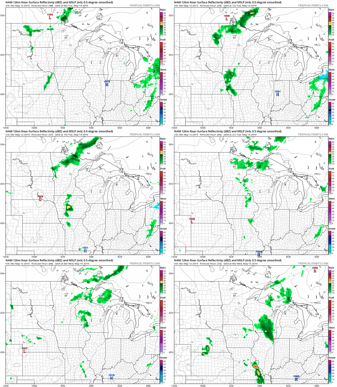
There will be a chance of a few showers and an isolated thunderstorm Tuesday and Tuesday evening. The National Oceanic and Atmospheric Administration's North American Mesoscale forecast model shows the potential rain pattern Tuesday through Tuesday evening:
As always, updated weather information can be heard on the Minnesota Public Radio Network, and you’ll also see updated weather info on the MPR News live weather blog.
River level update
There are still some locations in Minnesota where river levels are above flood stage. You can get flood warning updates by clicking on any green-shaded location on the National Weather Service Twin Cities website.
Here's how their map looked Sunday morning:

The latest flood warnings for northwestern Minnesota can be found on the NWS Grand Forks, N.D. site.
You can click on any location on the NWS Advanced Hydrologic Prediction Service (AHPS) site to get hydrographs of recent and forecast river levels. Some locations list levels in feet above sea level, others list levels in feet above a local reference point.
Here’s the Sunday morning hydrograph for the Mississippi River at St. Paul:

The Mississippi River is expected to rise slightly at St. Paul over the next couple of days, but remain below flood stage.
The lower portions of some trees on the eastern side of Raspberry Island were still under water Sunday morning:

Projected river levels are updated on a regular basis, so check back to the AHPS site and the NWS point forecasts for the latest info on the rivers near you.
If you’d like to scroll through hydrographs along a certain river in central or southern Minnesota, check here. Hydrographs for the Red River can be found here.
Programming note
You can hear my live weather updates on Minnesota Public Radio at 7:49 a.m. Thursdays and Fridays, and at 7:35 a.m., 9:35 a.m. and 4:35 p.m. each Saturday and Sunday.

