
Warmer temps this week, with a shot at 80 on Thursday
Go Deeper.
Create an account or log in to save stories.
Like this?
Thanks for liking this story! We have added it to a list of your favorite stories.


Our Twin Cities temperatures have been cooler than normal on 10 out of 12 days this May. That cool streak is about to end.
On to the details.
Temperature trends
Our average May 13 high temp is 69 degrees in the Twin Cities metro area. Most of the metro area will reach the upper 60s Monday afternoon. Highs across much of Minnesota and western Wisconsin will be well into the 60s on Monday, and a few spots in southwestern Minnesota could touch 70 degrees.
Turn Up Your Support
MPR News helps you turn down the noise and build shared understanding. Turn up your support for this public resource and keep trusted journalism accessible to all.
Temps ramp up a bit more on Tuesday:
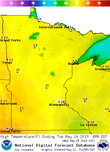
Some spots in the Twin Cities metro area will probably reach the lower 70s Tuesday afternoon. Metro area highs are projected to reach the mid 70s on Wednesday. It still looks like we'll top out around 80 degrees on Thursday, followed by upper 70s on Friday.
The last time that the temperature reached 80 degrees or warmer at Minneapolis-St. Paul International Airport was September 17, 2018.
Rain chances
Scattered showers and thunderstorms could move through Minnesota and parts of Wisconsin Tuesday afternoon and Tuesday evening. The National Oceanic and Atmospheric Administration’s North American Mesoscale forecast model shows the potential rain pattern Tuesday through Tuesday evening:
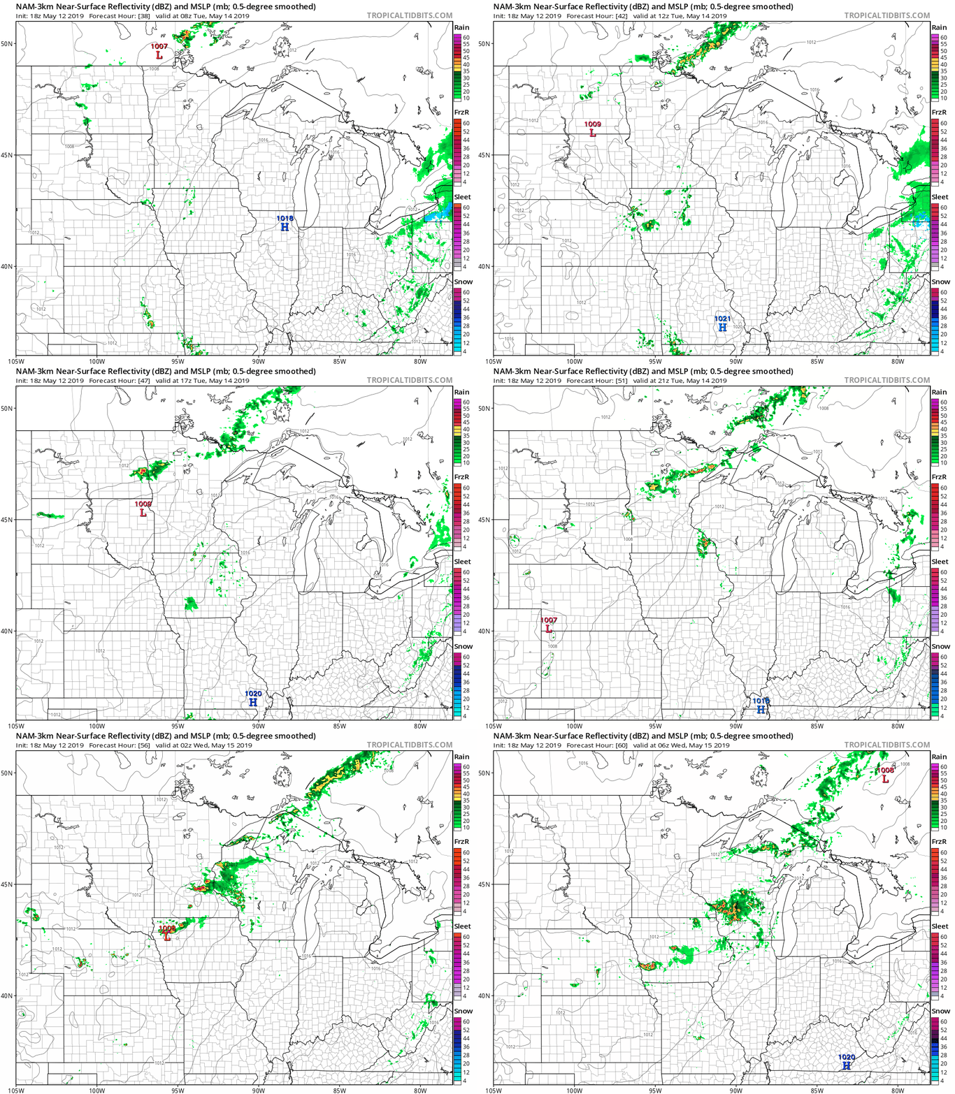
The color chart to the right of the loop refers to the strength of the signal that returns to the radar, not to the amount of rain.
As always, updated weather information can be heard on the Minnesota Public Radio Network, and you’ll also see updated weather info on the MPR News live weather blog.
We'll also have a chance of scattered showers and thunderstorms late Thursday and on Friday.
Here comes the sun
It's sometimes fun to look at the big picture in meteorology.
@NOAASatellites treated us to this loop of the sunrise spreading westward across the Earth's surface on Friday:
I never get tired of watching the "full disk" satellite loop.
Hope you have a good week!

