
Hot and humid weekend with a few storms
Go Deeper.
Create an account or log in to save stories.
Like this?
Thanks for liking this story! We have added it to a list of your favorite stories.


If you have been looking forward to sweltering weather, then this will be your kind of weekend. And we will throw in a few thunderstorms for good measure.
Seriously, though, steamy weather is dangerous for people and pets. Drinking plenty of water can keep you hydrated, but shade, fans and air conditioning are keys to comfort and safety.
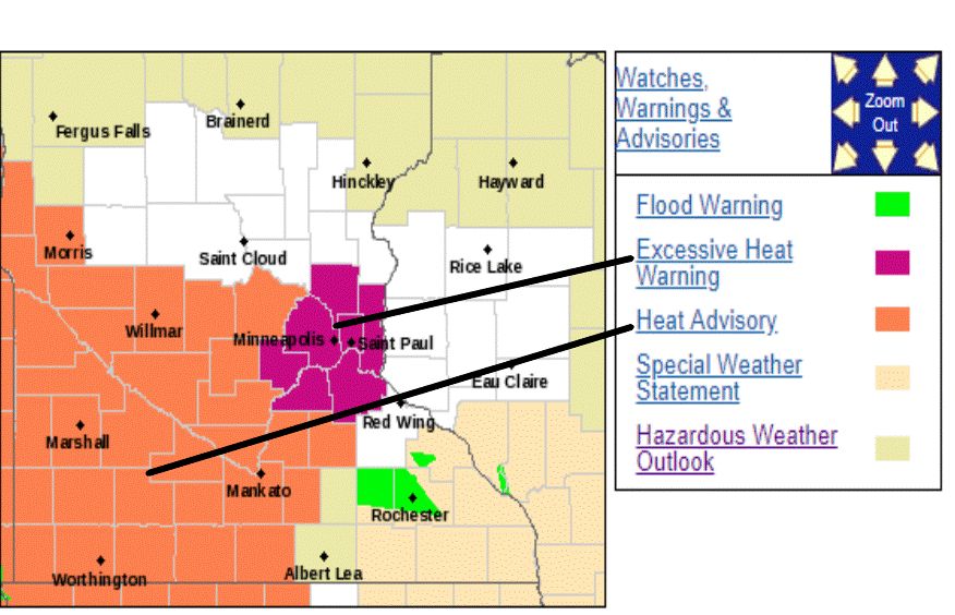
Some of the most extreme thermal conditions will be within the urban sprawl of the Twin Cities where temperatures tend to run a bit warmer than surrounding more rural areas. The National Weather Service has posted an Excessive Heat Warning for the seven-county metro area from 1 p.m. Saturday until 9 p.m. Sunday, as shown below.
A Heat Advisory for slightly less extreme conditions has been posted from 1 p.m. until 9 p.m. on Saturday for areas west and south of the Twin Cities area.
Turn Up Your Support
MPR News helps you turn down the noise and build shared understanding. Turn up your support for this public resource and keep trusted journalism accessible to all.
Now some specifics.
Saturday
Saturday will be hot statewide and very humid for most of us. Afternoon high temperatures should range from the mid 80s in the north to the mid 90s farther south. The Twin Cities should hit about 93 with a light southeast breeze.
Afternoon dew points are likely to spike into the oppressive low 70s for central, southern and western Minnesota including the Twin Cities area. Northeastern Minnesota will remain on the less humid side.
There will be some thunderstorms later on Saturday up north. Severe thunderstorms have been active early in the day across northern North Dakota.
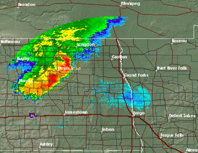
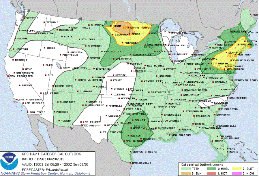
Some of these storms will spread into northwestern Minnesota by Saturday afternoon and then advance across northern portions of the state during the rest of the afternoon and Saturday night. Some storms could be severe. The Storm Prediction Center has upgraded the chance of severe storms in the northwestern corner to an enhanced risk.
Sunday
The heat and humidity will remain on for Sunday. Expect high temperatures mainly from the low 80s to mid 90s along with plenty of humidity.
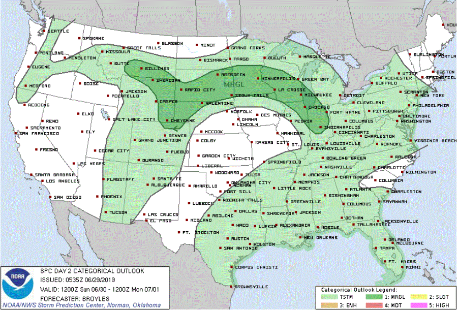
The main change for Sunday is that a cold front will track our way from the Dakotas. While its cooling effect will be minimal, the front will be a dynamic boundary to fire off thunderstorms, some of which might become severe.
A warm, unsettled week to begin July
Afternoon high temperatures will drop back to closer to seasonal normals beginning on Monday. That means high temperatures generally in the low to mid 80s for the Twin Cities area and mid 70s to low 80s farther north.
A series of atmospheric disturbances will bring at least the chance of scattered thunderstorms just about every day next week.

